You are here: Home > Network List > TA - USArray Transportable Network (new EarthScope stations) Stations List
> Station A21K Barrow, AK, USA > Earthquake Result Viewer
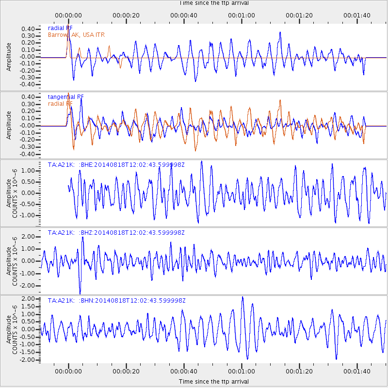
A21K Barrow, AK, USA - Earthquake Result Viewer
*The percent match for this event was below the threshold and hence no stack was calculated.
| Earthquake location: |
Iran-Iraq Border Region |
| Earthquake latitude/longitude: |
32.7/47.5 |
| Earthquake time(UTC): |
2014/08/18 (230) 11:51:34 GMT |
| Earthquake Depth: |
10 km |
| Earthquake Magnitude: |
5.8 MB |
| Earthquake Catalog/Contributor: |
NEIC PDE/NEIC COMCAT |
|
| Network: |
TA USArray Transportable Network (new EarthScope stations) |
| Station: |
A21K Barrow, AK, USA |
| Lat/Lon: |
71.32 N/156.62 W |
| Elevation: |
577 m |
|
| Distance: |
74.9 deg |
| Az: |
7.853 deg |
| Baz: |
339.05 deg |
| Ray Param: |
$rayparam |
*The percent match for this event was below the threshold and hence was not used in the summary stack. |
|
| Radial Match: |
59.23586 % |
| Radial Bump: |
400 |
| Transverse Match: |
36.699104 % |
| Transverse Bump: |
394 |
| SOD ConfigId: |
769524 |
| Insert Time: |
2014-09-01 12:22:19.041 +0000 |
| GWidth: |
2.5 |
| Max Bumps: |
400 |
| Tol: |
0.001 |
|
Signal To Noise
| Channel | StoN | STA | LTA |
| TA:A21K: :BHZ:20140818T12:02:43.599998Z | 2.1748416 | 9.354104E-7 | 4.3010508E-7 |
| TA:A21K: :BHN:20140818T12:02:43.599998Z | 0.95154405 | 4.703541E-7 | 4.9430616E-7 |
| TA:A21K: :BHE:20140818T12:02:43.599998Z | 1.3275635 | 6.713506E-7 | 5.0570134E-7 |
| Arrivals |
| Ps | |
| PpPs | |
| PsPs/PpSs | |


