You are here: Home > Network List > GS - US Geological Survey Networks Stations List
> Station KAN13 Rinehart Farm > Earthquake Result Viewer
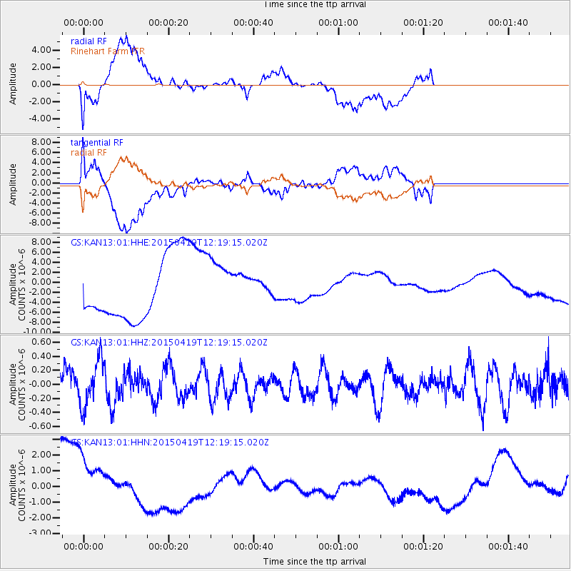
KAN13 Rinehart Farm - Earthquake Result Viewer
*The percent match for this event was below the threshold and hence no stack was calculated.
| Earthquake location: |
Southeast Of Honshu, Japan |
| Earthquake latitude/longitude: |
30.5/142.8 |
| Earthquake time(UTC): |
2015/04/19 (109) 12:06:37 GMT |
| Earthquake Depth: |
16 km |
| Earthquake Magnitude: |
5.1 MW, 4.5 MS, 5.2 mb |
| Earthquake Catalog/Contributor: |
ISC/ISC |
|
| Network: |
GS US Geological Survey Networks |
| Station: |
KAN13 Rinehart Farm |
| Lat/Lon: |
37.01 N/97.48 W |
| Elevation: |
340 m |
|
| Distance: |
92.3 deg |
| Az: |
44.072 deg |
| Baz: |
311.432 deg |
| Ray Param: |
$rayparam |
*The percent match for this event was below the threshold and hence was not used in the summary stack. |
|
| Radial Match: |
32.950207 % |
| Radial Bump: |
400 |
| Transverse Match: |
31.185434 % |
| Transverse Bump: |
400 |
| SOD ConfigId: |
7422571 |
| Insert Time: |
2019-04-18 06:05:17.233 +0000 |
| GWidth: |
2.5 |
| Max Bumps: |
400 |
| Tol: |
0.001 |
|
Signal To Noise
| Channel | StoN | STA | LTA |
| GS:KAN13:01:HHZ:20150419T12:19:15.020Z | 1.360315 | 3.3379683E-7 | 2.45382E-7 |
| GS:KAN13:01:HHN:20150419T12:19:15.020Z | 1.0283178 | 2.1392625E-6 | 2.0803514E-6 |
| GS:KAN13:01:HHE:20150419T12:19:15.020Z | 0.9602024 | 6.0058214E-6 | 6.2547456E-6 |
| Arrivals |
| Ps | |
| PpPs | |
| PsPs/PpSs | |


