You are here: Home > Network List > AV - Alaska Volcano Observatory Stations List
> Station MAPS Pakushin Southeast, Makushin Volcano, Alaska > Earthquake Result Viewer
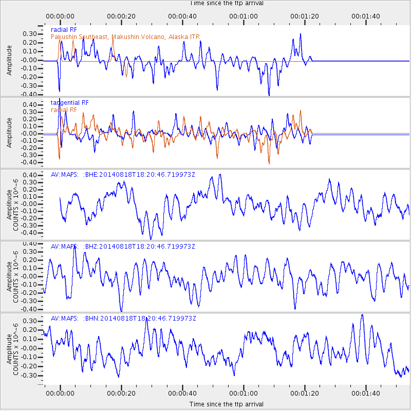
MAPS Pakushin Southeast, Makushin Volcano, Alaska - Earthquake Result Viewer
*The percent match for this event was below the threshold and hence no stack was calculated.
| Earthquake location: |
Iran-Iraq Border Region |
| Earthquake latitude/longitude: |
32.6/47.7 |
| Earthquake time(UTC): |
2014/08/18 (230) 18:08:23 GMT |
| Earthquake Depth: |
10 km |
| Earthquake Magnitude: |
5.7 MWB |
| Earthquake Catalog/Contributor: |
NEIC PDE/NEIC COMCAT |
|
| Network: |
AV Alaska Volcano Observatory |
| Station: |
MAPS Pakushin Southeast, Makushin Volcano, Alaska |
| Lat/Lon: |
53.81 N/166.94 W |
| Elevation: |
333 m |
|
| Distance: |
88.9 deg |
| Az: |
19.704 deg |
| Baz: |
331.307 deg |
| Ray Param: |
$rayparam |
*The percent match for this event was below the threshold and hence was not used in the summary stack. |
|
| Radial Match: |
65.26502 % |
| Radial Bump: |
400 |
| Transverse Match: |
37.143085 % |
| Transverse Bump: |
317 |
| SOD ConfigId: |
769524 |
| Insert Time: |
2014-09-01 18:22:55.630 +0000 |
| GWidth: |
2.5 |
| Max Bumps: |
400 |
| Tol: |
0.001 |
|
Signal To Noise
| Channel | StoN | STA | LTA |
| AV:MAPS: :BHZ:20140818T18:20:46.719973Z | 1.3613791 | 1.8466612E-7 | 1.3564636E-7 |
| AV:MAPS: :BHN:20140818T18:20:46.719973Z | 0.8902021 | 1.3257669E-7 | 1.4892876E-7 |
| AV:MAPS: :BHE:20140818T18:20:46.719973Z | 2.2159379 | 3.3515502E-7 | 1.5124748E-7 |
| Arrivals |
| Ps | |
| PpPs | |
| PsPs/PpSs | |


