You are here: Home > Network List > IW - Intermountain West Stations List
> Station MOOW Moose Ponds, Wyoming, USA > Earthquake Result Viewer
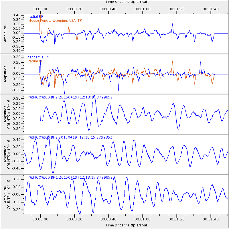
MOOW Moose Ponds, Wyoming, USA - Earthquake Result Viewer
*The percent match for this event was below the threshold and hence no stack was calculated.
| Earthquake location: |
Southeast Of Honshu, Japan |
| Earthquake latitude/longitude: |
30.5/142.8 |
| Earthquake time(UTC): |
2015/04/19 (109) 12:06:37 GMT |
| Earthquake Depth: |
16 km |
| Earthquake Magnitude: |
5.1 MW, 4.5 MS, 5.2 mb |
| Earthquake Catalog/Contributor: |
ISC/ISC |
|
| Network: |
IW Intermountain West |
| Station: |
MOOW Moose Ponds, Wyoming, USA |
| Lat/Lon: |
43.75 N/110.74 W |
| Elevation: |
2128 m |
|
| Distance: |
80.1 deg |
| Az: |
44.859 deg |
| Baz: |
302.886 deg |
| Ray Param: |
$rayparam |
*The percent match for this event was below the threshold and hence was not used in the summary stack. |
|
| Radial Match: |
62.490837 % |
| Radial Bump: |
362 |
| Transverse Match: |
71.80426 % |
| Transverse Bump: |
400 |
| SOD ConfigId: |
7422571 |
| Insert Time: |
2019-04-18 06:05:43.339 +0000 |
| GWidth: |
2.5 |
| Max Bumps: |
400 |
| Tol: |
0.001 |
|
Signal To Noise
| Channel | StoN | STA | LTA |
| IW:MOOW:00:BHZ:20150419T12:18:15.379985Z | 2.422293 | 3.216575E-7 | 1.327905E-7 |
| IW:MOOW:00:BH1:20150419T12:18:15.379985Z | 0.9448278 | 9.9831325E-8 | 1.0566087E-7 |
| IW:MOOW:00:BH2:20150419T12:18:15.379985Z | 1.9125015 | 2.3650887E-7 | 1.2366466E-7 |
| Arrivals |
| Ps | |
| PpPs | |
| PsPs/PpSs | |


