You are here: Home > Network List > TA - USArray Transportable Network (new EarthScope stations) Stations List
> Station I23K Minto, Yukon-Koyukuk, AK, USA > Earthquake Result Viewer
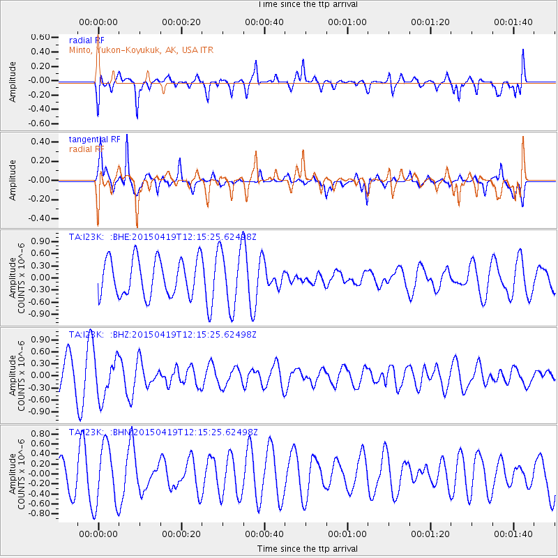
I23K Minto, Yukon-Koyukuk, AK, USA - Earthquake Result Viewer
*The percent match for this event was below the threshold and hence no stack was calculated.
| Earthquake location: |
Southeast Of Honshu, Japan |
| Earthquake latitude/longitude: |
30.5/142.8 |
| Earthquake time(UTC): |
2015/04/19 (109) 12:06:37 GMT |
| Earthquake Depth: |
16 km |
| Earthquake Magnitude: |
5.1 MW, 4.5 MS, 5.2 mb |
| Earthquake Catalog/Contributor: |
ISC/ISC |
|
| Network: |
TA USArray Transportable Network (new EarthScope stations) |
| Station: |
I23K Minto, Yukon-Koyukuk, AK, USA |
| Lat/Lon: |
65.15 N/149.36 W |
| Elevation: |
149 m |
|
| Distance: |
53.4 deg |
| Az: |
29.164 deg |
| Baz: |
264.206 deg |
| Ray Param: |
$rayparam |
*The percent match for this event was below the threshold and hence was not used in the summary stack. |
|
| Radial Match: |
48.546238 % |
| Radial Bump: |
400 |
| Transverse Match: |
60.823063 % |
| Transverse Bump: |
328 |
| SOD ConfigId: |
7422571 |
| Insert Time: |
2019-04-18 06:07:54.049 +0000 |
| GWidth: |
2.5 |
| Max Bumps: |
400 |
| Tol: |
0.001 |
|
Signal To Noise
| Channel | StoN | STA | LTA |
| TA:I23K: :BHZ:20150419T12:15:25.62498Z | 1.3329985 | 4.898497E-7 | 3.6747957E-7 |
| TA:I23K: :BHN:20150419T12:15:25.62498Z | 1.8252404 | 6.0159584E-7 | 3.2959812E-7 |
| TA:I23K: :BHE:20150419T12:15:25.62498Z | 1.6422096 | 7.4456204E-7 | 4.5339036E-7 |
| Arrivals |
| Ps | |
| PpPs | |
| PsPs/PpSs | |


