You are here: Home > Network List > TA - USArray Transportable Network (new EarthScope stations) Stations List
> Station J01E Myrtle Point, OR, USA > Earthquake Result Viewer
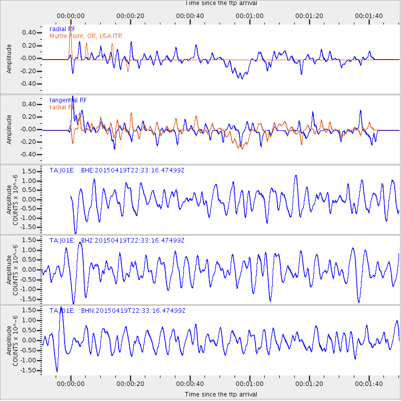
J01E Myrtle Point, OR, USA - Earthquake Result Viewer
*The percent match for this event was below the threshold and hence no stack was calculated.
| Earthquake location: |
Kuril Islands |
| Earthquake latitude/longitude: |
48.9/154.4 |
| Earthquake time(UTC): |
2015/04/19 (109) 22:24:35 GMT |
| Earthquake Depth: |
148 km |
| Earthquake Magnitude: |
4.0 mb, 4.1 mb |
| Earthquake Catalog/Contributor: |
ISC/ISC |
|
| Network: |
TA USArray Transportable Network (new EarthScope stations) |
| Station: |
J01E Myrtle Point, OR, USA |
| Lat/Lon: |
43.16 N/123.93 W |
| Elevation: |
128 m |
|
| Distance: |
54.4 deg |
| Az: |
62.942 deg |
| Baz: |
306.578 deg |
| Ray Param: |
$rayparam |
*The percent match for this event was below the threshold and hence was not used in the summary stack. |
|
| Radial Match: |
54.169724 % |
| Radial Bump: |
400 |
| Transverse Match: |
60.54432 % |
| Transverse Bump: |
400 |
| SOD ConfigId: |
7422571 |
| Insert Time: |
2019-04-18 06:18:55.058 +0000 |
| GWidth: |
2.5 |
| Max Bumps: |
400 |
| Tol: |
0.001 |
|
Signal To Noise
| Channel | StoN | STA | LTA |
| TA:J01E: :BHZ:20150419T22:33:16.47499Z | 2.3893034 | 1.0377505E-6 | 4.343318E-7 |
| TA:J01E: :BHN:20150419T22:33:16.47499Z | 0.7234777 | 3.327083E-7 | 4.5987363E-7 |
| TA:J01E: :BHE:20150419T22:33:16.47499Z | 0.5105969 | 3.3995568E-7 | 6.6580054E-7 |
| Arrivals |
| Ps | |
| PpPs | |
| PsPs/PpSs | |


