You are here: Home > Network List > WY - Yellowstone Wyoming Seismic Network Stations List
> Station YHH Holmes Hill, YNP, WY, USA > Earthquake Result Viewer
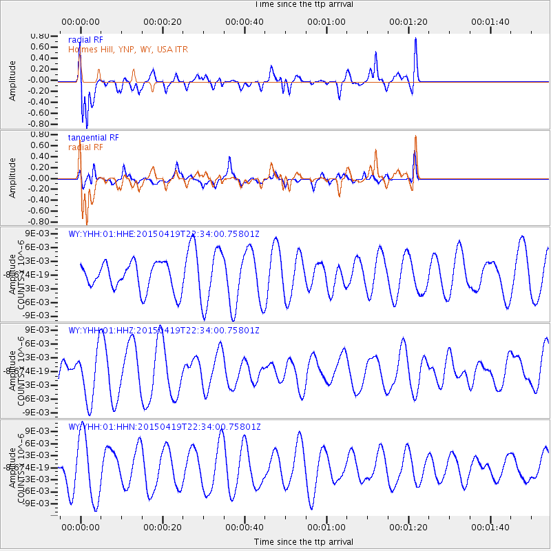
YHH Holmes Hill, YNP, WY, USA - Earthquake Result Viewer
*The percent match for this event was below the threshold and hence no stack was calculated.
| Earthquake location: |
Kuril Islands |
| Earthquake latitude/longitude: |
48.9/154.4 |
| Earthquake time(UTC): |
2015/04/19 (109) 22:24:35 GMT |
| Earthquake Depth: |
148 km |
| Earthquake Magnitude: |
4.0 mb, 4.1 mb |
| Earthquake Catalog/Contributor: |
ISC/ISC |
|
| Network: |
WY Yellowstone Wyoming Seismic Network |
| Station: |
YHH Holmes Hill, YNP, WY, USA |
| Lat/Lon: |
44.79 N/110.85 W |
| Elevation: |
2717 m |
|
| Distance: |
60.7 deg |
| Az: |
54.441 deg |
| Baz: |
311.077 deg |
| Ray Param: |
$rayparam |
*The percent match for this event was below the threshold and hence was not used in the summary stack. |
|
| Radial Match: |
72.092125 % |
| Radial Bump: |
400 |
| Transverse Match: |
66.80435 % |
| Transverse Bump: |
364 |
| SOD ConfigId: |
7422571 |
| Insert Time: |
2019-04-18 06:20:12.314 +0000 |
| GWidth: |
2.5 |
| Max Bumps: |
400 |
| Tol: |
0.001 |
|
Signal To Noise
| Channel | StoN | STA | LTA |
| WY:YHH:01:HHZ:20150419T22:34:00.75801Z | 1.9863282 | 5.6374327E-9 | 2.8381175E-9 |
| WY:YHH:01:HHN:20150419T22:34:00.75801Z | 2.3832262 | 8.2027904E-9 | 3.4418852E-9 |
| WY:YHH:01:HHE:20150419T22:34:00.75801Z | 1.992263 | 5.886842E-9 | 2.954852E-9 |
| Arrivals |
| Ps | |
| PpPs | |
| PsPs/PpSs | |


