You are here: Home > Network List > TA - USArray Transportable Network (new EarthScope stations) Stations List
> Station G59A Clarenceville, QC, USA > Earthquake Result Viewer
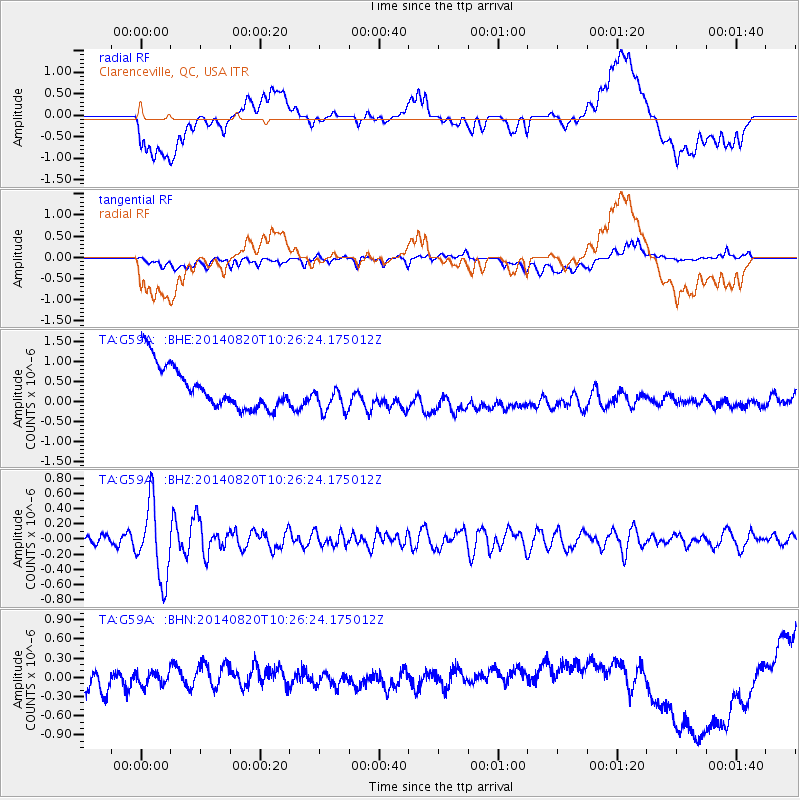
G59A Clarenceville, QC, USA - Earthquake Result Viewer
*The percent match for this event was below the threshold and hence no stack was calculated.
| Earthquake location: |
Iran-Iraq Border Region |
| Earthquake latitude/longitude: |
32.6/47.8 |
| Earthquake time(UTC): |
2014/08/20 (232) 10:14:15 GMT |
| Earthquake Depth: |
10 km |
| Earthquake Magnitude: |
5.7 M |
| Earthquake Catalog/Contributor: |
NEIC PDE/NEIC ALERT |
|
| Network: |
TA USArray Transportable Network (new EarthScope stations) |
| Station: |
G59A Clarenceville, QC, USA |
| Lat/Lon: |
45.08 N/73.18 W |
| Elevation: |
36 m |
|
| Distance: |
85.9 deg |
| Az: |
322.489 deg |
| Baz: |
46.481 deg |
| Ray Param: |
$rayparam |
*The percent match for this event was below the threshold and hence was not used in the summary stack. |
|
| Radial Match: |
13.1412 % |
| Radial Bump: |
400 |
| Transverse Match: |
42.501553 % |
| Transverse Bump: |
400 |
| SOD ConfigId: |
769524 |
| Insert Time: |
2014-09-03 11:03:40.492 +0000 |
| GWidth: |
2.5 |
| Max Bumps: |
400 |
| Tol: |
0.001 |
|
Signal To Noise
| Channel | StoN | STA | LTA |
| TA:G59A: :BHZ:20140820T10:26:24.175012Z | 3.7989478 | 4.9308824E-7 | 1.2979599E-7 |
| TA:G59A: :BHN:20140820T10:26:24.175012Z | 0.4678815 | 1.6543214E-7 | 3.53577E-7 |
| TA:G59A: :BHE:20140820T10:26:24.175012Z | 0.7904169 | 4.204522E-7 | 5.3193725E-7 |
| Arrivals |
| Ps | |
| PpPs | |
| PsPs/PpSs | |


