You are here: Home > Network List > TA - USArray Transportable Network (new EarthScope stations) Stations List
> Station G65A Princeton, ME, USA > Earthquake Result Viewer
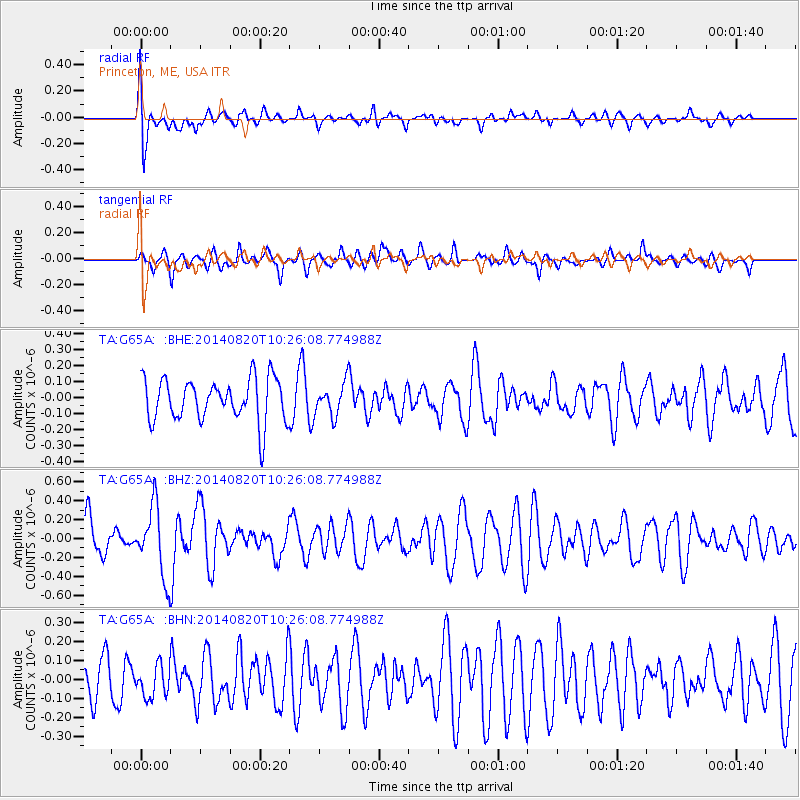
G65A Princeton, ME, USA - Earthquake Result Viewer
*The percent match for this event was below the threshold and hence no stack was calculated.
| Earthquake location: |
Iran-Iraq Border Region |
| Earthquake latitude/longitude: |
32.6/47.8 |
| Earthquake time(UTC): |
2014/08/20 (232) 10:14:15 GMT |
| Earthquake Depth: |
10 km |
| Earthquake Magnitude: |
5.7 M |
| Earthquake Catalog/Contributor: |
NEIC PDE/NEIC ALERT |
|
| Network: |
TA USArray Transportable Network (new EarthScope stations) |
| Station: |
G65A Princeton, ME, USA |
| Lat/Lon: |
45.20 N/67.56 W |
| Elevation: |
78 m |
|
| Distance: |
82.9 deg |
| Az: |
319.924 deg |
| Baz: |
50.2 deg |
| Ray Param: |
$rayparam |
*The percent match for this event was below the threshold and hence was not used in the summary stack. |
|
| Radial Match: |
70.234505 % |
| Radial Bump: |
400 |
| Transverse Match: |
50.95553 % |
| Transverse Bump: |
360 |
| SOD ConfigId: |
769524 |
| Insert Time: |
2014-09-03 11:04:03.854 +0000 |
| GWidth: |
2.5 |
| Max Bumps: |
400 |
| Tol: |
0.001 |
|
Signal To Noise
| Channel | StoN | STA | LTA |
| TA:G65A: :BHZ:20140820T10:26:08.774988Z | 2.014423 | 3.6771655E-7 | 1.8254187E-7 |
| TA:G65A: :BHN:20140820T10:26:08.774988Z | 0.6354216 | 8.206087E-8 | 1.2914397E-7 |
| TA:G65A: :BHE:20140820T10:26:08.774988Z | 0.7537728 | 1.0058039E-7 | 1.3343595E-7 |
| Arrivals |
| Ps | |
| PpPs | |
| PsPs/PpSs | |


