You are here: Home > Network List > TA - USArray Transportable Network (new EarthScope stations) Stations List
> Station A21K Barrow, AK, USA > Earthquake Result Viewer
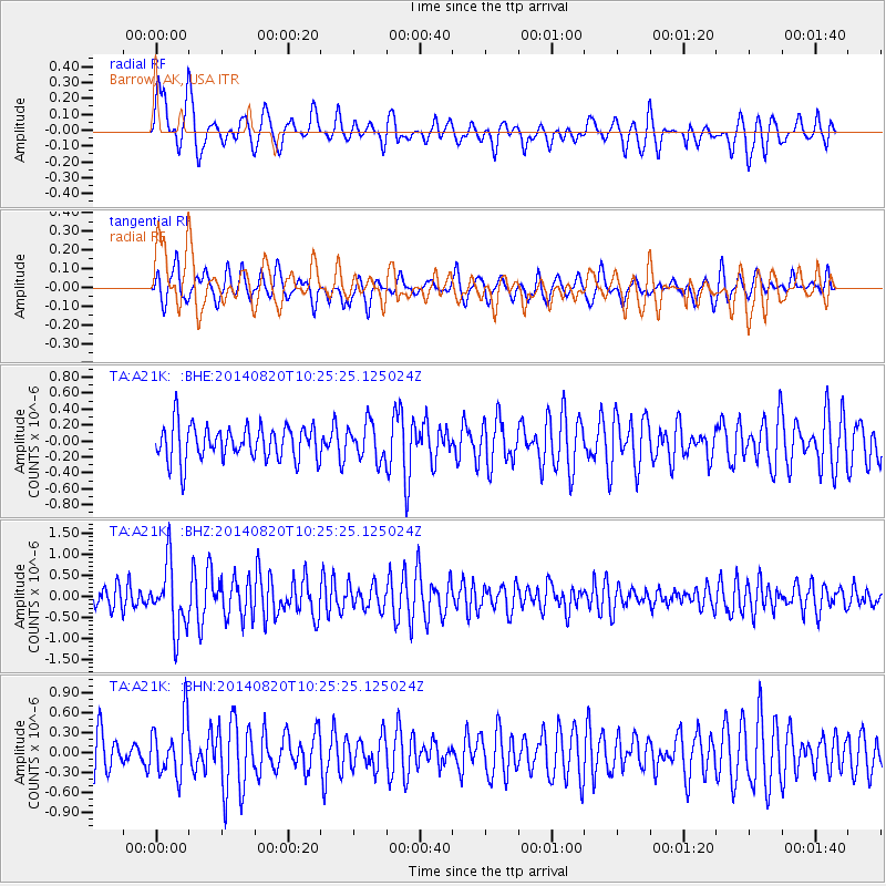
A21K Barrow, AK, USA - Earthquake Result Viewer
*The percent match for this event was below the threshold and hence no stack was calculated.
| Earthquake location: |
Iran-Iraq Border Region |
| Earthquake latitude/longitude: |
32.6/47.8 |
| Earthquake time(UTC): |
2014/08/20 (232) 10:14:15 GMT |
| Earthquake Depth: |
10 km |
| Earthquake Magnitude: |
5.7 M |
| Earthquake Catalog/Contributor: |
NEIC PDE/NEIC ALERT |
|
| Network: |
TA USArray Transportable Network (new EarthScope stations) |
| Station: |
A21K Barrow, AK, USA |
| Lat/Lon: |
71.32 N/156.62 W |
| Elevation: |
577 m |
|
| Distance: |
74.9 deg |
| Az: |
7.931 deg |
| Baz: |
338.818 deg |
| Ray Param: |
$rayparam |
*The percent match for this event was below the threshold and hence was not used in the summary stack. |
|
| Radial Match: |
68.29636 % |
| Radial Bump: |
400 |
| Transverse Match: |
57.63825 % |
| Transverse Bump: |
400 |
| SOD ConfigId: |
769524 |
| Insert Time: |
2014-09-03 11:10:43.356 +0000 |
| GWidth: |
2.5 |
| Max Bumps: |
400 |
| Tol: |
0.001 |
|
Signal To Noise
| Channel | StoN | STA | LTA |
| TA:A21K: :BHZ:20140820T10:25:25.125024Z | 2.08432 | 7.782958E-7 | 3.7340516E-7 |
| TA:A21K: :BHN:20140820T10:25:25.125024Z | 1.0994742 | 4.2653755E-7 | 3.8794687E-7 |
| TA:A21K: :BHE:20140820T10:25:25.125024Z | 1.0274831 | 2.2456294E-7 | 2.1855632E-7 |
| Arrivals |
| Ps | |
| PpPs | |
| PsPs/PpSs | |


