You are here: Home > Network List > US - United States National Seismic Network Stations List
> Station ERPA Erie, Pennsylvania, USA > Earthquake Result Viewer
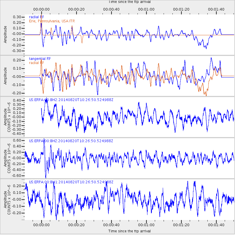
ERPA Erie, Pennsylvania, USA - Earthquake Result Viewer
*The percent match for this event was below the threshold and hence no stack was calculated.
| Earthquake location: |
Iran-Iraq Border Region |
| Earthquake latitude/longitude: |
32.6/47.8 |
| Earthquake time(UTC): |
2014/08/20 (232) 10:14:15 GMT |
| Earthquake Depth: |
10 km |
| Earthquake Magnitude: |
5.7 M |
| Earthquake Catalog/Contributor: |
NEIC PDE/NEIC ALERT |
|
| Network: |
US United States National Seismic Network |
| Station: |
ERPA Erie, Pennsylvania, USA |
| Lat/Lon: |
42.12 N/79.99 W |
| Elevation: |
306 m |
|
| Distance: |
91.5 deg |
| Az: |
323.976 deg |
| Baz: |
41.831 deg |
| Ray Param: |
$rayparam |
*The percent match for this event was below the threshold and hence was not used in the summary stack. |
|
| Radial Match: |
45.941833 % |
| Radial Bump: |
400 |
| Transverse Match: |
40.88091 % |
| Transverse Bump: |
400 |
| SOD ConfigId: |
769524 |
| Insert Time: |
2014-09-03 11:11:35.856 +0000 |
| GWidth: |
2.5 |
| Max Bumps: |
400 |
| Tol: |
0.001 |
|
Signal To Noise
| Channel | StoN | STA | LTA |
| US:ERPA:00:BHZ:20140820T10:26:50.524988Z | 3.2102172 | 3.4013405E-7 | 1.0595359E-7 |
| US:ERPA:00:BH1:20140820T10:26:50.524988Z | 1.3149347 | 1.2055354E-7 | 9.168024E-8 |
| US:ERPA:00:BH2:20140820T10:26:50.524988Z | 1.0473 | 1.8012483E-7 | 1.7198971E-7 |
| Arrivals |
| Ps | |
| PpPs | |
| PsPs/PpSs | |


