You are here: Home > Network List > TA - USArray Transportable Network (new EarthScope stations) Stations List
> Station A21K Barrow, AK, USA > Earthquake Result Viewer
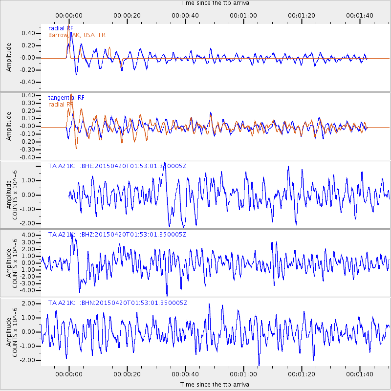
A21K Barrow, AK, USA - Earthquake Result Viewer
*The percent match for this event was below the threshold and hence no stack was calculated.
| Earthquake location: |
Taiwan Region |
| Earthquake latitude/longitude: |
24.1/122.3 |
| Earthquake time(UTC): |
2015/04/20 (110) 01:42:58 GMT |
| Earthquake Depth: |
29 km |
| Earthquake Magnitude: |
6.6 MWP, 6.6 MI |
| Earthquake Catalog/Contributor: |
NEIC PDE/NEIC COMCAT |
|
| Network: |
TA USArray Transportable Network (new EarthScope stations) |
| Station: |
A21K Barrow, AK, USA |
| Lat/Lon: |
71.32 N/156.62 W |
| Elevation: |
577 m |
|
| Distance: |
64.5 deg |
| Az: |
20.648 deg |
| Baz: |
269.77 deg |
| Ray Param: |
$rayparam |
*The percent match for this event was below the threshold and hence was not used in the summary stack. |
|
| Radial Match: |
77.34183 % |
| Radial Bump: |
400 |
| Transverse Match: |
65.30848 % |
| Transverse Bump: |
400 |
| SOD ConfigId: |
7422571 |
| Insert Time: |
2019-04-18 06:26:45.019 +0000 |
| GWidth: |
2.5 |
| Max Bumps: |
400 |
| Tol: |
0.001 |
|
Signal To Noise
| Channel | StoN | STA | LTA |
| TA:A21K: :BHZ:20150420T01:53:01.350005Z | 3.5621111 | 2.494307E-6 | 7.002328E-7 |
| TA:A21K: :BHN:20150420T01:53:01.350005Z | 1.4192809 | 7.832677E-7 | 5.5187644E-7 |
| TA:A21K: :BHE:20150420T01:53:01.350005Z | 2.2366853 | 1.3234843E-6 | 5.9171686E-7 |
| Arrivals |
| Ps | |
| PpPs | |
| PsPs/PpSs | |


