You are here: Home > Network List > TA - USArray Transportable Network (new EarthScope stations) Stations List
> Station O03E Paynes Creek, CA, USA > Earthquake Result Viewer
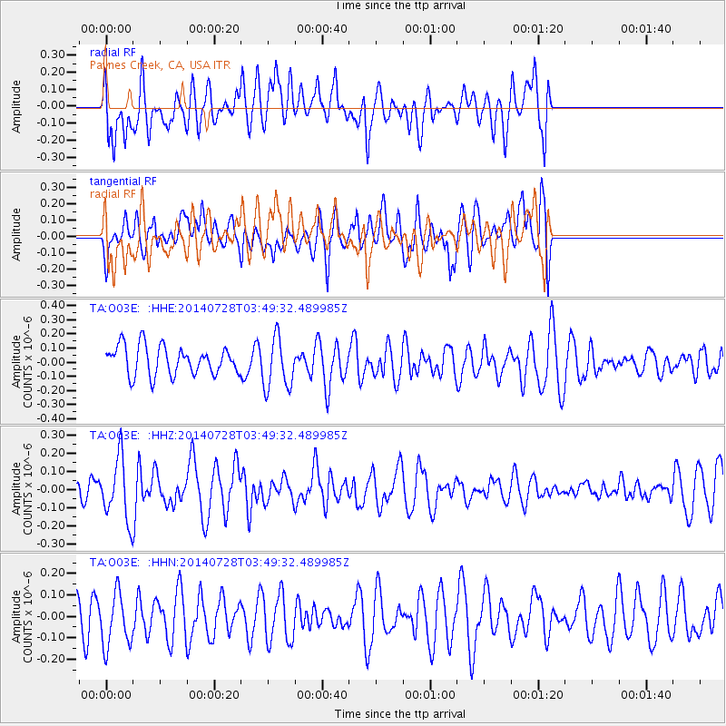
O03E Paynes Creek, CA, USA - Earthquake Result Viewer
*The percent match for this event was below the threshold and hence no stack was calculated.
| Earthquake location: |
W. Caroline Islands, Micronesia |
| Earthquake latitude/longitude: |
7.5/136.8 |
| Earthquake time(UTC): |
2014/07/28 (209) 03:36:45 GMT |
| Earthquake Depth: |
4.2 km |
| Earthquake Magnitude: |
5.6 MWW, 5.5 MWC, 5.6 MWB |
| Earthquake Catalog/Contributor: |
NEIC PDE/NEIC COMCAT |
|
| Network: |
TA USArray Transportable Network (new EarthScope stations) |
| Station: |
O03E Paynes Creek, CA, USA |
| Lat/Lon: |
40.29 N/121.80 W |
| Elevation: |
967 m |
|
| Distance: |
93.8 deg |
| Az: |
48.71 deg |
| Baz: |
283.075 deg |
| Ray Param: |
$rayparam |
*The percent match for this event was below the threshold and hence was not used in the summary stack. |
|
| Radial Match: |
41.19596 % |
| Radial Bump: |
400 |
| Transverse Match: |
67.99487 % |
| Transverse Bump: |
400 |
| SOD ConfigId: |
769524 |
| Insert Time: |
2014-09-05 23:24:46.415 +0000 |
| GWidth: |
2.5 |
| Max Bumps: |
400 |
| Tol: |
0.001 |
|
Signal To Noise
| Channel | StoN | STA | LTA |
| TA:O03E: :HHZ:20140728T03:49:32.489985Z | 2.52155 | 1.711432E-7 | 6.787222E-8 |
| TA:O03E: :HHN:20140728T03:49:32.489985Z | 1.7962683 | 1.2895136E-7 | 7.178847E-8 |
| TA:O03E: :HHE:20140728T03:49:32.489985Z | 1.8096522 | 1.8446939E-7 | 1.0193638E-7 |
| Arrivals |
| Ps | |
| PpPs | |
| PsPs/PpSs | |


