You are here: Home > Network List > UW - Pacific Northwest Regional Seismic Network Stations List
> Station HOOD Mt Hood Meadows, OR CREST BB SMO > Earthquake Result Viewer
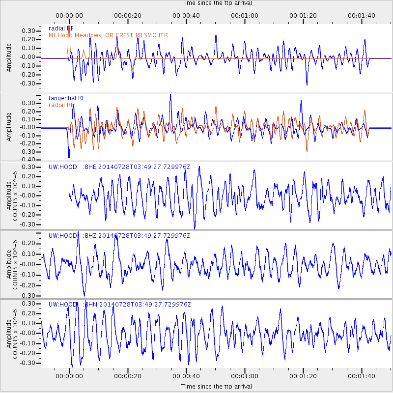
HOOD Mt Hood Meadows, OR CREST BB SMO - Earthquake Result Viewer
*The percent match for this event was below the threshold and hence no stack was calculated.
| Earthquake location: |
W. Caroline Islands, Micronesia |
| Earthquake latitude/longitude: |
7.5/136.8 |
| Earthquake time(UTC): |
2014/07/28 (209) 03:36:45 GMT |
| Earthquake Depth: |
4.2 km |
| Earthquake Magnitude: |
5.6 MWW, 5.5 MWC, 5.6 MWB |
| Earthquake Catalog/Contributor: |
NEIC PDE/NEIC COMCAT |
|
| Network: |
UW Pacific Northwest Regional Seismic Network |
| Station: |
HOOD Mt Hood Meadows, OR CREST BB SMO |
| Lat/Lon: |
45.32 N/121.65 W |
| Elevation: |
1520 m |
|
| Distance: |
92.8 deg |
| Az: |
43.787 deg |
| Baz: |
283.46 deg |
| Ray Param: |
$rayparam |
*The percent match for this event was below the threshold and hence was not used in the summary stack. |
|
| Radial Match: |
45.531925 % |
| Radial Bump: |
400 |
| Transverse Match: |
54.03716 % |
| Transverse Bump: |
400 |
| SOD ConfigId: |
769524 |
| Insert Time: |
2014-09-05 23:27:27.318 +0000 |
| GWidth: |
2.5 |
| Max Bumps: |
400 |
| Tol: |
0.001 |
|
Signal To Noise
| Channel | StoN | STA | LTA |
| UW:HOOD: :BHZ:20140728T03:49:27.729976Z | 1.5964793 | 1.1950046E-7 | 7.4852494E-8 |
| UW:HOOD: :BHN:20140728T03:49:27.729976Z | 1.874847 | 2.2300674E-7 | 1.1894664E-7 |
| UW:HOOD: :BHE:20140728T03:49:27.729976Z | 1.0532002 | 1.13764315E-7 | 1.0801774E-7 |
| Arrivals |
| Ps | |
| PpPs | |
| PsPs/PpSs | |


