You are here: Home > Network List > UW - Pacific Northwest Regional Seismic Network Stations List
> Station LCCR Mulino, OR, USA > Earthquake Result Viewer
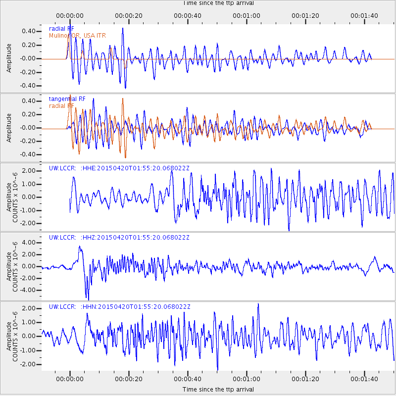
LCCR Mulino, OR, USA - Earthquake Result Viewer
*The percent match for this event was below the threshold and hence no stack was calculated.
| Earthquake location: |
Taiwan Region |
| Earthquake latitude/longitude: |
24.1/122.3 |
| Earthquake time(UTC): |
2015/04/20 (110) 01:42:58 GMT |
| Earthquake Depth: |
29 km |
| Earthquake Magnitude: |
6.6 MWP, 6.6 MI |
| Earthquake Catalog/Contributor: |
NEIC PDE/NEIC COMCAT |
|
| Network: |
UW Pacific Northwest Regional Seismic Network |
| Station: |
LCCR Mulino, OR, USA |
| Lat/Lon: |
45.21 N/122.48 W |
| Elevation: |
273 m |
|
| Distance: |
89.3 deg |
| Az: |
39.775 deg |
| Baz: |
304.224 deg |
| Ray Param: |
$rayparam |
*The percent match for this event was below the threshold and hence was not used in the summary stack. |
|
| Radial Match: |
58.335552 % |
| Radial Bump: |
400 |
| Transverse Match: |
72.789375 % |
| Transverse Bump: |
400 |
| SOD ConfigId: |
7422571 |
| Insert Time: |
2019-04-18 06:27:44.353 +0000 |
| GWidth: |
2.5 |
| Max Bumps: |
400 |
| Tol: |
0.001 |
|
Signal To Noise
| Channel | StoN | STA | LTA |
| UW:LCCR: :HHZ:20150420T01:55:20.068022Z | 5.674619 | 1.5876227E-6 | 2.797761E-7 |
| UW:LCCR: :HHN:20150420T01:55:20.068022Z | 1.8090549 | 6.360582E-7 | 3.5159698E-7 |
| UW:LCCR: :HHE:20150420T01:55:20.068022Z | 1.8918827 | 9.061757E-7 | 4.7898095E-7 |
| Arrivals |
| Ps | |
| PpPs | |
| PsPs/PpSs | |


