You are here: Home > Network List > UW - Pacific Northwest Regional Seismic Network Stations List
> Station PASS Maple Falls, WA, USA > Earthquake Result Viewer
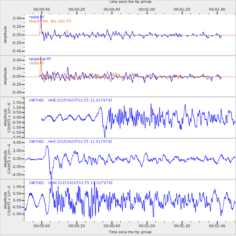
PASS Maple Falls, WA, USA - Earthquake Result Viewer
*The percent match for this event was below the threshold and hence no stack was calculated.
| Earthquake location: |
Taiwan Region |
| Earthquake latitude/longitude: |
24.1/122.3 |
| Earthquake time(UTC): |
2015/04/20 (110) 01:42:58 GMT |
| Earthquake Depth: |
29 km |
| Earthquake Magnitude: |
6.6 MWP, 6.6 MI |
| Earthquake Catalog/Contributor: |
NEIC PDE/NEIC COMCAT |
|
| Network: |
UW Pacific Northwest Regional Seismic Network |
| Station: |
PASS Maple Falls, WA, USA |
| Lat/Lon: |
49.00 N/122.09 W |
| Elevation: |
174 m |
|
| Distance: |
87.4 deg |
| Az: |
36.489 deg |
| Baz: |
304.415 deg |
| Ray Param: |
$rayparam |
*The percent match for this event was below the threshold and hence was not used in the summary stack. |
|
| Radial Match: |
78.30147 % |
| Radial Bump: |
400 |
| Transverse Match: |
73.50871 % |
| Transverse Bump: |
400 |
| SOD ConfigId: |
7422571 |
| Insert Time: |
2019-04-18 06:27:48.883 +0000 |
| GWidth: |
2.5 |
| Max Bumps: |
400 |
| Tol: |
0.001 |
|
Signal To Noise
| Channel | StoN | STA | LTA |
| UW:PASS: :HHZ:20150420T01:55:11.017974Z | 7.925716 | 1.8591522E-6 | 2.3457216E-7 |
| UW:PASS: :HHN:20150420T01:55:11.017974Z | 1.760461 | 5.6588806E-7 | 3.2144314E-7 |
| UW:PASS: :HHE:20150420T01:55:11.017974Z | 3.3178663 | 6.086907E-7 | 1.8345847E-7 |
| Arrivals |
| Ps | |
| PpPs | |
| PsPs/PpSs | |


