You are here: Home > Network List > TA - USArray Transportable Network (new EarthScope stations) Stations List
> Station G59A Clarenceville, QC, USA > Earthquake Result Viewer
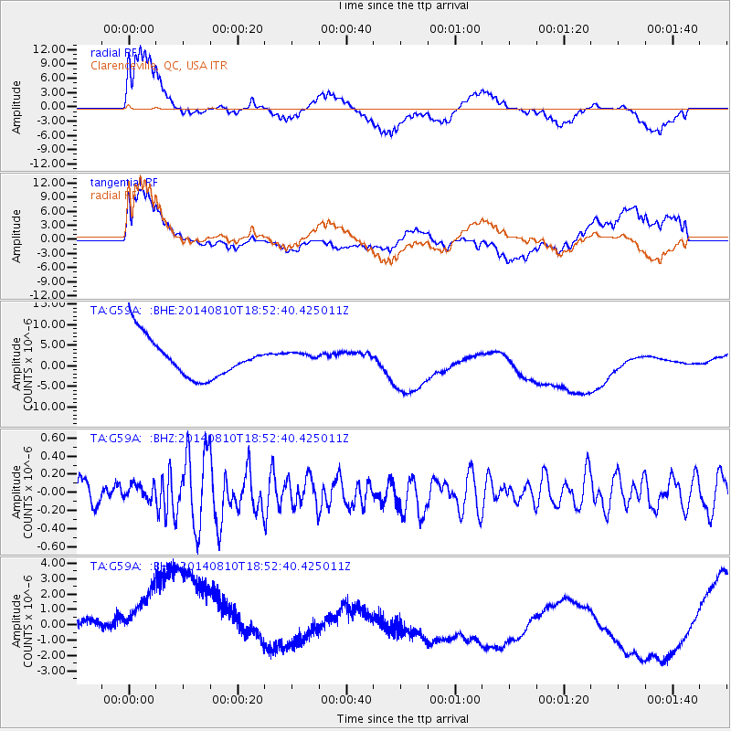
G59A Clarenceville, QC, USA - Earthquake Result Viewer
*The percent match for this event was below the threshold and hence no stack was calculated.
| Earthquake location: |
Gulf Of California |
| Earthquake latitude/longitude: |
27.6/-111.6 |
| Earthquake time(UTC): |
2014/08/10 (222) 18:46:17 GMT |
| Earthquake Depth: |
10 km |
| Earthquake Magnitude: |
5.5 MWW, 5.4 MWB, 5.5 MWC |
| Earthquake Catalog/Contributor: |
NEIC PDE/NEIC COMCAT |
|
| Network: |
TA USArray Transportable Network (new EarthScope stations) |
| Station: |
G59A Clarenceville, QC, USA |
| Lat/Lon: |
45.08 N/73.18 W |
| Elevation: |
36 m |
|
| Distance: |
35.1 deg |
| Az: |
49.965 deg |
| Baz: |
253.481 deg |
| Ray Param: |
$rayparam |
*The percent match for this event was below the threshold and hence was not used in the summary stack. |
|
| Radial Match: |
49.57667 % |
| Radial Bump: |
400 |
| Transverse Match: |
48.635006 % |
| Transverse Bump: |
400 |
| SOD ConfigId: |
769524 |
| Insert Time: |
2014-09-06 17:55:56.628 +0000 |
| GWidth: |
2.5 |
| Max Bumps: |
400 |
| Tol: |
0.001 |
|
Signal To Noise
| Channel | StoN | STA | LTA |
| TA:G59A: :BHZ:20140810T18:52:40.425011Z | 0.5722208 | 8.0170196E-8 | 1.4010361E-7 |
| TA:G59A: :BHN:20140810T18:52:40.425011Z | 1.240715 | 5.980878E-6 | 4.820509E-6 |
| TA:G59A: :BHE:20140810T18:52:40.425011Z | 0.3205552 | 1.4942577E-6 | 4.6614673E-6 |
| Arrivals |
| Ps | |
| PpPs | |
| PsPs/PpSs | |


