You are here: Home > Network List > TA - USArray Transportable Network (new EarthScope stations) Stations List
> Station H57A Richville, NY, USA > Earthquake Result Viewer
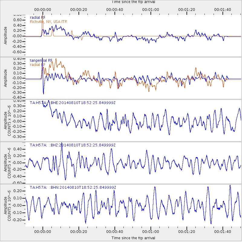
H57A Richville, NY, USA - Earthquake Result Viewer
*The percent match for this event was below the threshold and hence no stack was calculated.
| Earthquake location: |
Gulf Of California |
| Earthquake latitude/longitude: |
27.6/-111.6 |
| Earthquake time(UTC): |
2014/08/10 (222) 18:46:17 GMT |
| Earthquake Depth: |
10 km |
| Earthquake Magnitude: |
5.5 MWW, 5.4 MWB, 5.5 MWC |
| Earthquake Catalog/Contributor: |
NEIC PDE/NEIC COMCAT |
|
| Network: |
TA USArray Transportable Network (new EarthScope stations) |
| Station: |
H57A Richville, NY, USA |
| Lat/Lon: |
44.46 N/75.39 W |
| Elevation: |
132 m |
|
| Distance: |
33.4 deg |
| Az: |
50.187 deg |
| Baz: |
252.113 deg |
| Ray Param: |
$rayparam |
*The percent match for this event was below the threshold and hence was not used in the summary stack. |
|
| Radial Match: |
37.598312 % |
| Radial Bump: |
400 |
| Transverse Match: |
52.56425 % |
| Transverse Bump: |
400 |
| SOD ConfigId: |
769524 |
| Insert Time: |
2014-09-06 17:56:06.584 +0000 |
| GWidth: |
2.5 |
| Max Bumps: |
400 |
| Tol: |
0.001 |
|
Signal To Noise
| Channel | StoN | STA | LTA |
| TA:H57A: :BHZ:20140810T18:52:25.849999Z | 1.4977566 | 1.5155861E-7 | 1.0119041E-7 |
| TA:H57A: :BHN:20140810T18:52:25.849999Z | 0.9617387 | 8.317468E-8 | 8.648366E-8 |
| TA:H57A: :BHE:20140810T18:52:25.849999Z | 1.3022528 | 1.809459E-7 | 1.3894838E-7 |
| Arrivals |
| Ps | |
| PpPs | |
| PsPs/PpSs | |


