You are here: Home > Network List > TA - USArray Transportable Network (new EarthScope stations) Stations List
> Station R11A Troy Canyon, Currant, NV, USA > Earthquake Result Viewer
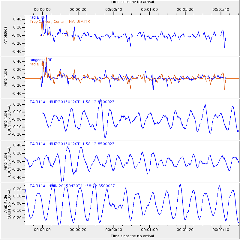
R11A Troy Canyon, Currant, NV, USA - Earthquake Result Viewer
*The percent match for this event was below the threshold and hence no stack was calculated.
| Earthquake location: |
Taiwan Region |
| Earthquake latitude/longitude: |
24.1/122.5 |
| Earthquake time(UTC): |
2015/04/20 (110) 11:45:14 GMT |
| Earthquake Depth: |
36 km |
| Earthquake Magnitude: |
6.2 MWP |
| Earthquake Catalog/Contributor: |
NEIC PDE/NEIC COMCAT |
|
| Network: |
TA USArray Transportable Network (new EarthScope stations) |
| Station: |
R11A Troy Canyon, Currant, NV, USA |
| Lat/Lon: |
38.35 N/115.59 W |
| Elevation: |
1756 m |
|
| Distance: |
97.5 deg |
| Az: |
42.285 deg |
| Baz: |
308.539 deg |
| Ray Param: |
$rayparam |
*The percent match for this event was below the threshold and hence was not used in the summary stack. |
|
| Radial Match: |
58.009575 % |
| Radial Bump: |
381 |
| Transverse Match: |
76.4017 % |
| Transverse Bump: |
368 |
| SOD ConfigId: |
7422571 |
| Insert Time: |
2019-04-18 06:44:01.794 +0000 |
| GWidth: |
2.5 |
| Max Bumps: |
400 |
| Tol: |
0.001 |
|
Signal To Noise
| Channel | StoN | STA | LTA |
| TA:R11A: :BHZ:20150420T11:58:12.850002Z | 0.8430285 | 1.0483006E-7 | 1.2434936E-7 |
| TA:R11A: :BHN:20150420T11:58:12.850002Z | 0.7805671 | 1.3475216E-7 | 1.7263366E-7 |
| TA:R11A: :BHE:20150420T11:58:12.850002Z | 2.0203333 | 1.6264396E-7 | 8.050352E-8 |
| Arrivals |
| Ps | |
| PpPs | |
| PsPs/PpSs | |


