You are here: Home > Network List > II - Global Seismograph Network (GSN - IRIS/IDA) Stations List
> Station XPFO Pinon Flat, California, USA > Earthquake Result Viewer
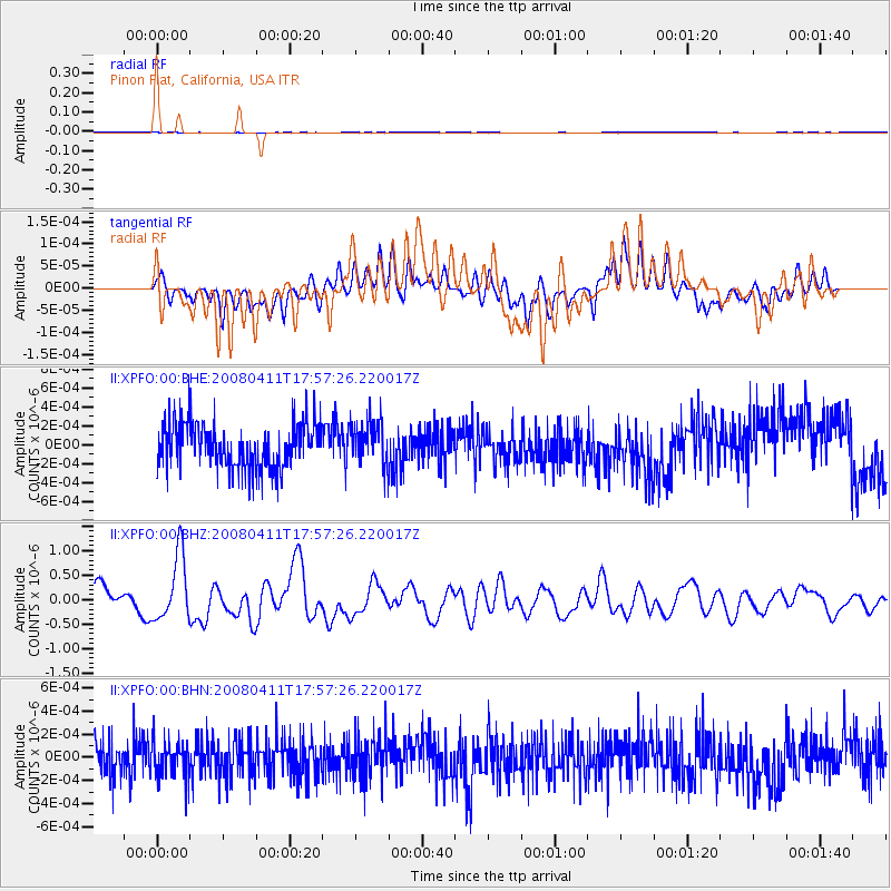
XPFO Pinon Flat, California, USA - Earthquake Result Viewer
*The percent match for this event was below the threshold and hence no stack was calculated.
| Earthquake location: |
Loyalty Islands |
| Earthquake latitude/longitude: |
-20.4/168.8 |
| Earthquake time(UTC): |
2008/04/11 (102) 17:45:05 GMT |
| Earthquake Depth: |
35 km |
| Earthquake Magnitude: |
5.7 MB, 5.9 MS, 6.0 MW, 6.0 MW |
| Earthquake Catalog/Contributor: |
WHDF/NEIC |
|
| Network: |
II Global Seismograph Network (GSN - IRIS/IDA) |
| Station: |
XPFO Pinon Flat, California, USA |
| Lat/Lon: |
33.61 N/116.46 W |
| Elevation: |
1280 m |
|
| Distance: |
89.1 deg |
| Az: |
53.624 deg |
| Baz: |
244.822 deg |
| Ray Param: |
$rayparam |
*The percent match for this event was below the threshold and hence was not used in the summary stack. |
|
| Radial Match: |
34.071514 % |
| Radial Bump: |
400 |
| Transverse Match: |
45.286144 % |
| Transverse Bump: |
400 |
| SOD ConfigId: |
2504 |
| Insert Time: |
2010-03-02 01:00:46.503 +0000 |
| GWidth: |
2.5 |
| Max Bumps: |
400 |
| Tol: |
0.001 |
|
Signal To Noise
| Channel | StoN | STA | LTA |
| II:XPFO:00:BHZ:20080411T17:57:26.220017Z | 2.6384344 | 6.643657E-7 | 2.5180302E-7 |
| II:XPFO:00:BHN:20080411T17:57:26.220017Z | 0.9600667 | 1.4510716E-10 | 1.5114279E-10 |
| II:XPFO:00:BHE:20080411T17:57:26.220017Z | 0.9841519 | 2.334821E-10 | 2.3724192E-10 |
| Arrivals |
| Ps | |
| PpPs | |
| PsPs/PpSs | |


