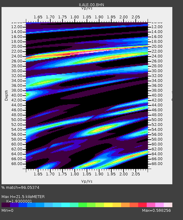
ALE Alert, N.W.T., Canada - Earthquake Result Viewer

Earthquake location: Near Coast Of Guerrero, Mexico
Earthquake latitude/longitude: 17.0/-100.9
Earthquake time(UTC): 2002/04/18 (108) 05:02:46 GMT
Earthquake Depth: 25 km
Earthquake Magnitude: 5.4 MB, 6.0 MS, 6.3 MW, 6.1 MW
Earthquake Catalog/Contributor: WHDF/NEIC
Network: II Global Seismograph Network (GSN - IRIS/IDA)
Station: ALE Alert, N.W.T., Canada
Lat/Lon: 82.50 N/62.35 W
Elevation: 60 m
Distance: 67.3 deg
Az: 5.087 deg
Baz: 220.241 deg
Ray Param: 0.057024103
Estimated Moho Depth: 21.5 km
Estimated Crust Vp/Vs: 1.93
Assumed Crust Vp: 6.287 km/s
Estimated Crust Vs: 3.258 km/s
Estimated Crust Poisson's Ratio: 0.32
Radial Match: 96.05374 %
Radial Bump: 324
Transverse Match: 87.76067 %
Transverse Bump: 400
SOD ConfigId: 20082
Insert Time: 2010-03-02 01:01:09.207 +0000
GWidth: 2.5
Max Bumps: 400
Tol: 0.001

Signal To Noise

ChannelStoNSTALTA
II:ALE:00:BHN:20020418T05:13:07.622007Z2.3789062.1158691E-78.894294E-8
II:ALE:00:BHE:20020418T05:13:07.622007Z3.31855631.7158278E-75.1704045E-8
II:ALE:00:BHZ:20020418T05:13:07.622007Z4.69163855.6113566E-71.1960334E-7
Arrivals
Ps3.3 SECOND
PpPs9.7 SECOND
PsPs/PpSs13 SECOND