You are here: Home > Network List > TA - USArray Transportable Network (new EarthScope stations) Stations List
> Station T57A Hurt, VA, USA > Earthquake Result Viewer
T57A Hurt, VA, USA - Earthquake Result Viewer

| Earthquake location: |
Near Coast Of Central Chile |
| Earthquake latitude/longitude: |
-32.7/-71.4 |
| Earthquake time(UTC): |
2014/08/23 (235) 22:32:23 GMT |
| Earthquake Depth: |
32 km |
| Earthquake Magnitude: |
6.4 MWW, 6.6 MWP |
| Earthquake Catalog/Contributor: |
NEIC PDE/NEIC COMCAT |
|
| Network: |
TA USArray Transportable Network (new EarthScope stations) |
| Station: |
T57A Hurt, VA, USA |
| Lat/Lon: |
37.00 N/79.25 W |
| Elevation: |
230 m |
|
| Distance: |
69.7 deg |
| Az: |
353.292 deg |
| Baz: |
172.934 deg |
| Ray Param: |
0.055405203 |
| Estimated Moho Depth: |
50.5 km |
| Estimated Crust Vp/Vs: |
1.62 |
| Assumed Crust Vp: |
6.419 km/s |
| Estimated Crust Vs: |
3.975 km/s |
| Estimated Crust Poisson's Ratio: |
0.19 |
|
| Radial Match: |
95.1106 % |
| Radial Bump: |
350 |
| Transverse Match: |
84.53013 % |
| Transverse Bump: |
400 |
| SOD ConfigId: |
769524 |
| Insert Time: |
2014-09-06 23:14:08.195 +0000 |
| GWidth: |
2.5 |
| Max Bumps: |
400 |
| Tol: |
0.001 |
|
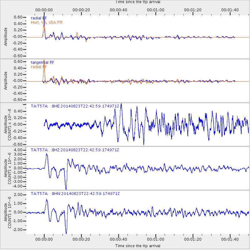
Signal To Noise
| Channel | StoN | STA | LTA |
| TA:T57A: :BHZ:20140823T22:42:59.174971Z | 20.466133 | 1.5217393E-6 | 7.435402E-8 |
| TA:T57A: :BHN:20140823T22:42:59.174971Z | 18.922604 | 7.1682956E-7 | 3.7882185E-8 |
| TA:T57A: :BHE:20140823T22:42:59.174971Z | 2.7294195 | 1.4146082E-7 | 5.1828167E-8 |
| Arrivals |
| Ps | 5.0 SECOND |
| PpPs | 20 SECOND |
| PsPs/PpSs | 25 SECOND |


