You are here: Home > Network List > TA - USArray Transportable Network (new EarthScope stations) Stations List
> Station X58A Rowland, NC, USA > Earthquake Result Viewer
X58A Rowland, NC, USA - Earthquake Result Viewer

| Earthquake location: |
Near Coast Of Central Chile |
| Earthquake latitude/longitude: |
-32.7/-71.4 |
| Earthquake time(UTC): |
2014/08/23 (235) 22:32:23 GMT |
| Earthquake Depth: |
32 km |
| Earthquake Magnitude: |
6.4 MWW, 6.6 MWP |
| Earthquake Catalog/Contributor: |
NEIC PDE/NEIC COMCAT |
|
| Network: |
TA USArray Transportable Network (new EarthScope stations) |
| Station: |
X58A Rowland, NC, USA |
| Lat/Lon: |
34.55 N/79.34 W |
| Elevation: |
45 m |
|
| Distance: |
67.3 deg |
| Az: |
352.891 deg |
| Baz: |
172.737 deg |
| Ray Param: |
0.056985546 |
| Estimated Moho Depth: |
34.5 km |
| Estimated Crust Vp/Vs: |
1.76 |
| Assumed Crust Vp: |
6.565 km/s |
| Estimated Crust Vs: |
3.719 km/s |
| Estimated Crust Poisson's Ratio: |
0.26 |
|
| Radial Match: |
91.22388 % |
| Radial Bump: |
400 |
| Transverse Match: |
77.847946 % |
| Transverse Bump: |
400 |
| SOD ConfigId: |
769524 |
| Insert Time: |
2014-09-06 23:15:40.562 +0000 |
| GWidth: |
2.5 |
| Max Bumps: |
400 |
| Tol: |
0.001 |
|
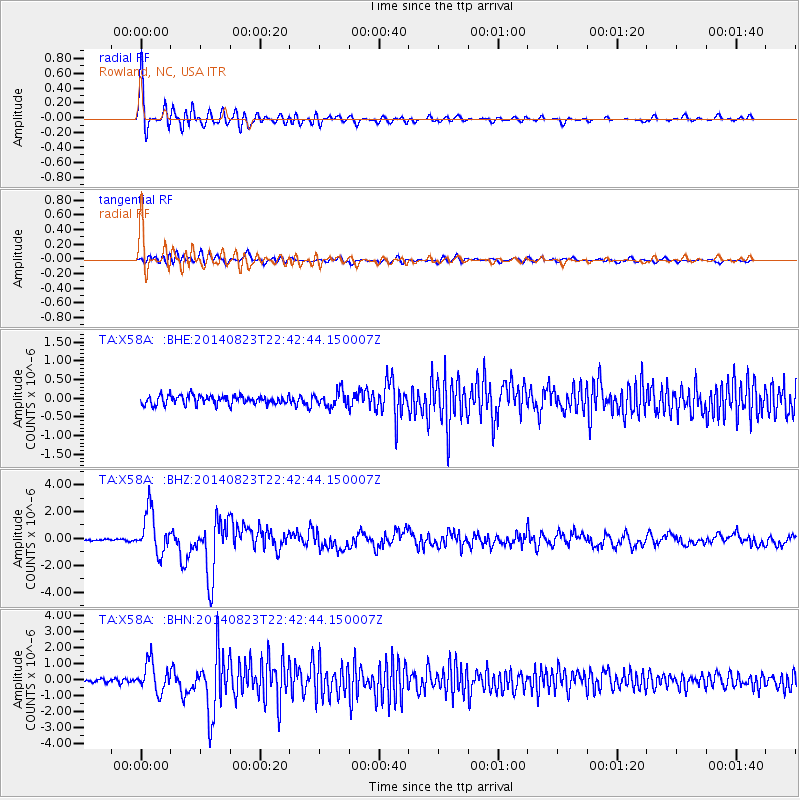
Signal To Noise
| Channel | StoN | STA | LTA |
| TA:X58A: :BHZ:20140823T22:42:44.150007Z | 20.13222 | 1.5470333E-6 | 7.6843655E-8 |
| TA:X58A: :BHN:20140823T22:42:44.150007Z | 5.9393606 | 9.1760194E-7 | 1.5449507E-7 |
| TA:X58A: :BHE:20140823T22:42:44.150007Z | 1.7119449 | 2.0271257E-7 | 1.1841068E-7 |
| Arrivals |
| Ps | 4.2 SECOND |
| PpPs | 14 SECOND |
| PsPs/PpSs | 18 SECOND |


