You are here: Home > Network List > US - United States National Seismic Network Stations List
> Station DGMT Dagmar, Montana, USA > Earthquake Result Viewer
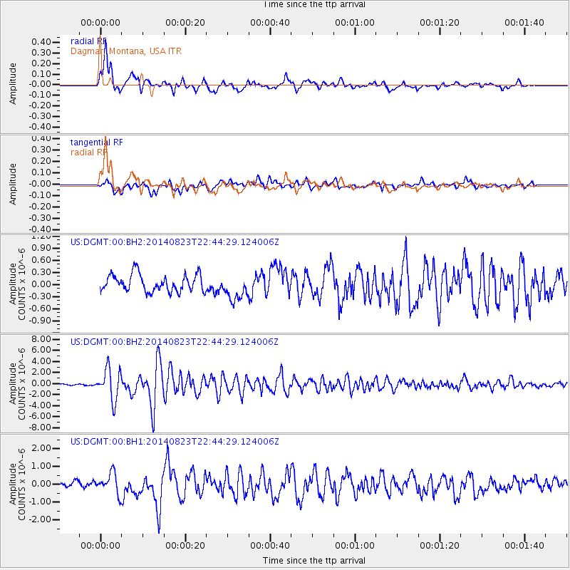
DGMT Dagmar, Montana, USA - Earthquake Result Viewer
*The percent match for this event was below the threshold and hence no stack was calculated.
| Earthquake location: |
Near Coast Of Central Chile |
| Earthquake latitude/longitude: |
-32.7/-71.4 |
| Earthquake time(UTC): |
2014/08/23 (235) 22:32:23 GMT |
| Earthquake Depth: |
32 km |
| Earthquake Magnitude: |
6.4 MWW, 6.6 MWP |
| Earthquake Catalog/Contributor: |
NEIC PDE/NEIC COMCAT |
|
| Network: |
US United States National Seismic Network |
| Station: |
DGMT Dagmar, Montana, USA |
| Lat/Lon: |
48.47 N/104.20 W |
| Elevation: |
0.0 m |
|
| Distance: |
86.0 deg |
| Az: |
338.809 deg |
| Baz: |
152.744 deg |
| Ray Param: |
$rayparam |
*The percent match for this event was below the threshold and hence was not used in the summary stack. |
|
| Radial Match: |
89.60677 % |
| Radial Bump: |
400 |
| Transverse Match: |
79.963776 % |
| Transverse Bump: |
400 |
| SOD ConfigId: |
769524 |
| Insert Time: |
2014-09-06 23:16:55.822 +0000 |
| GWidth: |
2.5 |
| Max Bumps: |
400 |
| Tol: |
0.001 |
|
Signal To Noise
| Channel | StoN | STA | LTA |
| US:DGMT:00:BHZ:20140823T22:44:29.124006Z | 26.736034 | 2.874414E-6 | 1.0751085E-7 |
| US:DGMT:00:BH1:20140823T22:44:29.124006Z | 3.3475394 | 6.0022387E-7 | 1.79303E-7 |
| US:DGMT:00:BH2:20140823T22:44:29.124006Z | 1.5795829 | 3.3434023E-7 | 2.116636E-7 |
| Arrivals |
| Ps | |
| PpPs | |
| PsPs/PpSs | |


