You are here: Home > Network List > TA - USArray Transportable Network (new EarthScope stations) Stations List
> Station I23K Minto, Yukon-Koyukuk, AK, USA > Earthquake Result Viewer
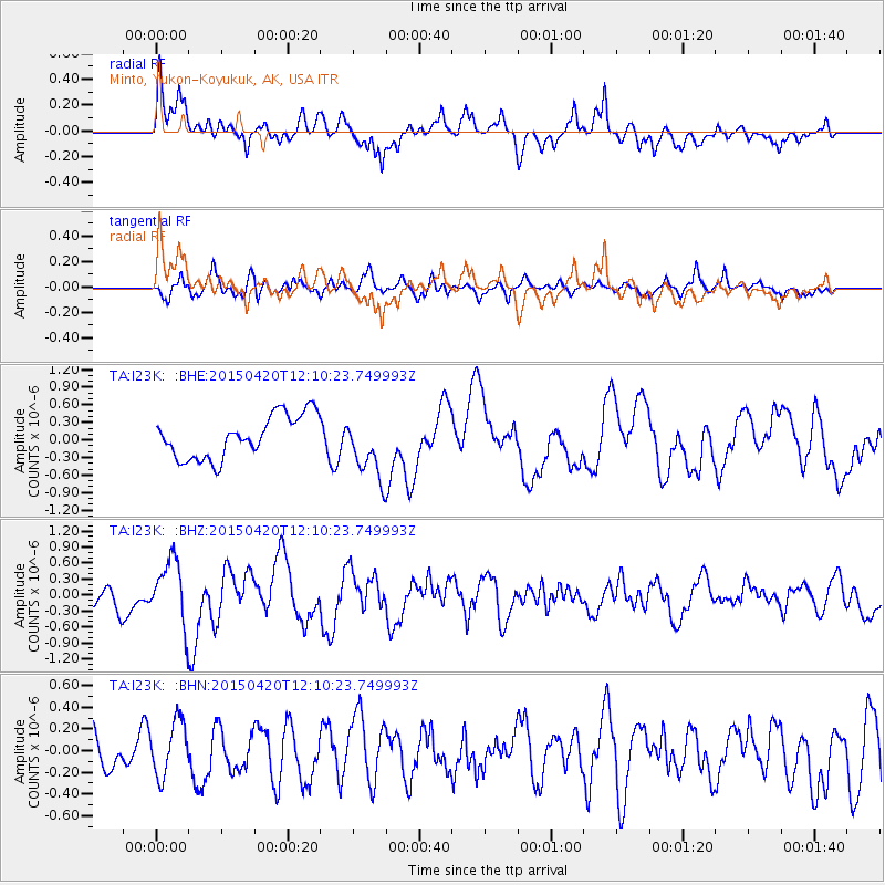
I23K Minto, Yukon-Koyukuk, AK, USA - Earthquake Result Viewer
*The percent match for this event was below the threshold and hence no stack was calculated.
| Earthquake location: |
Taiwan Region |
| Earthquake latitude/longitude: |
24.1/122.5 |
| Earthquake time(UTC): |
2015/04/20 (110) 11:59:59 GMT |
| Earthquake Depth: |
20 km |
| Earthquake Magnitude: |
6.1 MWW |
| Earthquake Catalog/Contributor: |
NEIC PDE/NEIC COMCAT |
|
| Network: |
TA USArray Transportable Network (new EarthScope stations) |
| Station: |
I23K Minto, Yukon-Koyukuk, AK, USA |
| Lat/Lon: |
65.15 N/149.36 W |
| Elevation: |
149 m |
|
| Distance: |
67.6 deg |
| Az: |
27.175 deg |
| Baz: |
278.998 deg |
| Ray Param: |
$rayparam |
*The percent match for this event was below the threshold and hence was not used in the summary stack. |
|
| Radial Match: |
50.147106 % |
| Radial Bump: |
400 |
| Transverse Match: |
65.04996 % |
| Transverse Bump: |
400 |
| SOD ConfigId: |
7422571 |
| Insert Time: |
2019-04-18 06:50:21.340 +0000 |
| GWidth: |
2.5 |
| Max Bumps: |
400 |
| Tol: |
0.001 |
|
Signal To Noise
| Channel | StoN | STA | LTA |
| TA:I23K: :BHZ:20150420T12:10:23.749993Z | 3.3363712 | 6.0210283E-7 | 1.8046639E-7 |
| TA:I23K: :BHN:20150420T12:10:23.749993Z | 1.6262348 | 2.4909687E-7 | 1.5317399E-7 |
| TA:I23K: :BHE:20150420T12:10:23.749993Z | 1.2362838 | 4.4741464E-7 | 3.6190283E-7 |
| Arrivals |
| Ps | |
| PpPs | |
| PsPs/PpSs | |


