You are here: Home > Network List > UW - Pacific Northwest Regional Seismic Network Stations List
> Station PASS Maple Falls, WA, USA > Earthquake Result Viewer
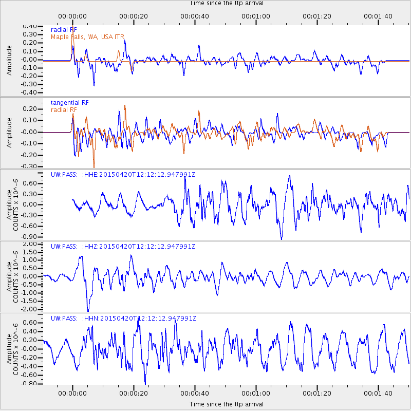
PASS Maple Falls, WA, USA - Earthquake Result Viewer
*The percent match for this event was below the threshold and hence no stack was calculated.
| Earthquake location: |
Taiwan Region |
| Earthquake latitude/longitude: |
24.1/122.5 |
| Earthquake time(UTC): |
2015/04/20 (110) 11:59:59 GMT |
| Earthquake Depth: |
20 km |
| Earthquake Magnitude: |
6.1 MWW |
| Earthquake Catalog/Contributor: |
NEIC PDE/NEIC COMCAT |
|
| Network: |
UW Pacific Northwest Regional Seismic Network |
| Station: |
PASS Maple Falls, WA, USA |
| Lat/Lon: |
49.00 N/122.09 W |
| Elevation: |
174 m |
|
| Distance: |
87.3 deg |
| Az: |
36.548 deg |
| Baz: |
304.269 deg |
| Ray Param: |
$rayparam |
*The percent match for this event was below the threshold and hence was not used in the summary stack. |
|
| Radial Match: |
61.304024 % |
| Radial Bump: |
400 |
| Transverse Match: |
53.50928 % |
| Transverse Bump: |
400 |
| SOD ConfigId: |
7422571 |
| Insert Time: |
2019-04-18 06:50:59.120 +0000 |
| GWidth: |
2.5 |
| Max Bumps: |
400 |
| Tol: |
0.001 |
|
Signal To Noise
| Channel | StoN | STA | LTA |
| UW:PASS: :HHZ:20150420T12:12:12.947991Z | 6.2354727 | 7.7099946E-7 | 1.2364733E-7 |
| UW:PASS: :HHN:20150420T12:12:12.947991Z | 0.96528256 | 2.529334E-7 | 2.6203043E-7 |
| UW:PASS: :HHE:20150420T12:12:12.947991Z | 1.1729805 | 2.0011356E-7 | 1.7060263E-7 |
| Arrivals |
| Ps | |
| PpPs | |
| PsPs/PpSs | |


