You are here: Home > Network List > CI - Caltech Regional Seismic Network Stations List
> Station SWS Sam W. Stewart, Westmorland, CA, USA > Earthquake Result Viewer
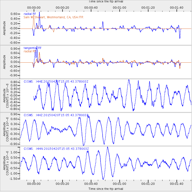
SWS Sam W. Stewart, Westmorland, CA, USA - Earthquake Result Viewer
*The percent match for this event was below the threshold and hence no stack was calculated.
| Earthquake location: |
Kuril Islands |
| Earthquake latitude/longitude: |
46.2/151.6 |
| Earthquake time(UTC): |
2015/04/20 (110) 14:55:21 GMT |
| Earthquake Depth: |
100 km |
| Earthquake Magnitude: |
4.4 mb, 4.4 mb |
| Earthquake Catalog/Contributor: |
ISC/ISC |
|
| Network: |
CI Caltech Regional Seismic Network |
| Station: |
SWS Sam W. Stewart, Westmorland, CA, USA |
| Lat/Lon: |
32.94 N/115.80 W |
| Elevation: |
140 m |
|
| Distance: |
68.8 deg |
| Az: |
64.319 deg |
| Baz: |
311.88 deg |
| Ray Param: |
$rayparam |
*The percent match for this event was below the threshold and hence was not used in the summary stack. |
|
| Radial Match: |
73.36058 % |
| Radial Bump: |
400 |
| Transverse Match: |
83.47937 % |
| Transverse Bump: |
384 |
| SOD ConfigId: |
7422571 |
| Insert Time: |
2019-04-18 06:54:38.491 +0000 |
| GWidth: |
2.5 |
| Max Bumps: |
400 |
| Tol: |
0.001 |
|
Signal To Noise
| Channel | StoN | STA | LTA |
| CI:SWS: :HHZ:20150420T15:05:43.378003Z | 1.2359684 | 4.4117786E-7 | 3.569492E-7 |
| CI:SWS: :HHN:20150420T15:05:43.378003Z | 2.961671 | 6.3481616E-7 | 2.143439E-7 |
| CI:SWS: :HHE:20150420T15:05:43.378003Z | 0.6995329 | 3.6257174E-7 | 5.1830546E-7 |
| Arrivals |
| Ps | |
| PpPs | |
| PsPs/PpSs | |


