You are here: Home > Network List > TA - USArray Transportable Network (new EarthScope stations) Stations List
> Station G59A Clarenceville, QC, USA > Earthquake Result Viewer
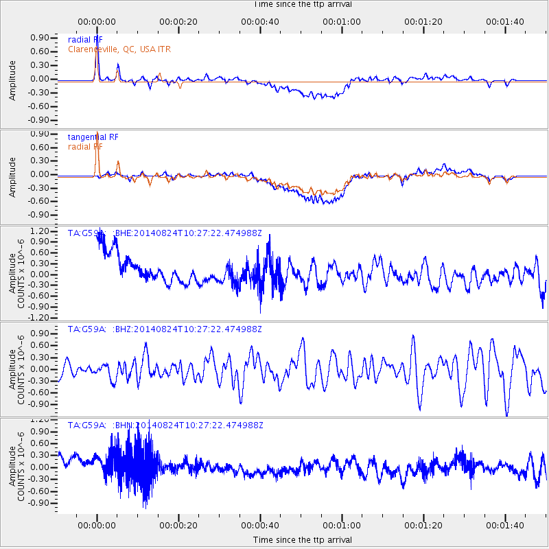
G59A Clarenceville, QC, USA - Earthquake Result Viewer
*The percent match for this event was below the threshold and hence no stack was calculated.
| Earthquake location: |
Northern California |
| Earthquake latitude/longitude: |
38.2/-122.3 |
| Earthquake time(UTC): |
2014/08/24 (236) 10:20:44 GMT |
| Earthquake Depth: |
7.8 km |
| Earthquake Magnitude: |
6.0 MW, 6.1 MI |
| Earthquake Catalog/Contributor: |
NEIC PDE/NEIC ALERT |
|
| Network: |
TA USArray Transportable Network (new EarthScope stations) |
| Station: |
G59A Clarenceville, QC, USA |
| Lat/Lon: |
45.08 N/73.18 W |
| Elevation: |
36 m |
|
| Distance: |
36.9 deg |
| Az: |
63.217 deg |
| Baz: |
276.957 deg |
| Ray Param: |
$rayparam |
*The percent match for this event was below the threshold and hence was not used in the summary stack. |
|
| Radial Match: |
68.823715 % |
| Radial Bump: |
400 |
| Transverse Match: |
48.584484 % |
| Transverse Bump: |
400 |
| SOD ConfigId: |
769524 |
| Insert Time: |
2014-09-07 10:49:15.977 +0000 |
| GWidth: |
2.5 |
| Max Bumps: |
400 |
| Tol: |
0.001 |
|
Signal To Noise
| Channel | StoN | STA | LTA |
| TA:G59A: :BHZ:20140824T10:27:22.474988Z | 1.0686353 | 1.9737921E-7 | 1.8470212E-7 |
| TA:G59A: :BHN:20140824T10:27:22.474988Z | 0.9362999 | 7.067587E-7 | 7.5484223E-7 |
| TA:G59A: :BHE:20140824T10:27:22.474988Z | 0.8909162 | 3.5521694E-7 | 3.9870966E-7 |
| Arrivals |
| Ps | |
| PpPs | |
| PsPs/PpSs | |


