You are here: Home > Network List > TA - USArray Transportable Network (new EarthScope stations) Stations List
> Station J61A Chester, VT, USA > Earthquake Result Viewer
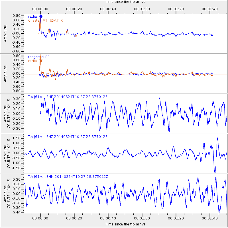
J61A Chester, VT, USA - Earthquake Result Viewer
*The percent match for this event was below the threshold and hence no stack was calculated.
| Earthquake location: |
Northern California |
| Earthquake latitude/longitude: |
38.2/-122.3 |
| Earthquake time(UTC): |
2014/08/24 (236) 10:20:44 GMT |
| Earthquake Depth: |
7.8 km |
| Earthquake Magnitude: |
6.0 MW, 6.1 MI |
| Earthquake Catalog/Contributor: |
NEIC PDE/NEIC ALERT |
|
| Network: |
TA USArray Transportable Network (new EarthScope stations) |
| Station: |
J61A Chester, VT, USA |
| Lat/Lon: |
43.35 N/72.55 W |
| Elevation: |
253 m |
|
| Distance: |
37.6 deg |
| Az: |
65.946 deg |
| Baz: |
279.566 deg |
| Ray Param: |
$rayparam |
*The percent match for this event was below the threshold and hence was not used in the summary stack. |
|
| Radial Match: |
79.17896 % |
| Radial Bump: |
311 |
| Transverse Match: |
35.089455 % |
| Transverse Bump: |
400 |
| SOD ConfigId: |
769524 |
| Insert Time: |
2014-09-07 10:50:06.514 +0000 |
| GWidth: |
2.5 |
| Max Bumps: |
400 |
| Tol: |
0.001 |
|
Signal To Noise
| Channel | StoN | STA | LTA |
| TA:J61A: :BHZ:20140824T10:27:28.375012Z | 2.118585 | 2.6302496E-7 | 1.2415123E-7 |
| TA:J61A: :BHN:20140824T10:27:28.375012Z | 0.8514965 | 1.07365736E-7 | 1.2609063E-7 |
| TA:J61A: :BHE:20140824T10:27:28.375012Z | 1.1180679 | 1.3108216E-7 | 1.1723991E-7 |
| Arrivals |
| Ps | |
| PpPs | |
| PsPs/PpSs | |


