You are here: Home > Network List > TA - USArray Transportable Network (new EarthScope stations) Stations List
> Station P54A Burton, WV, USA > Earthquake Result Viewer
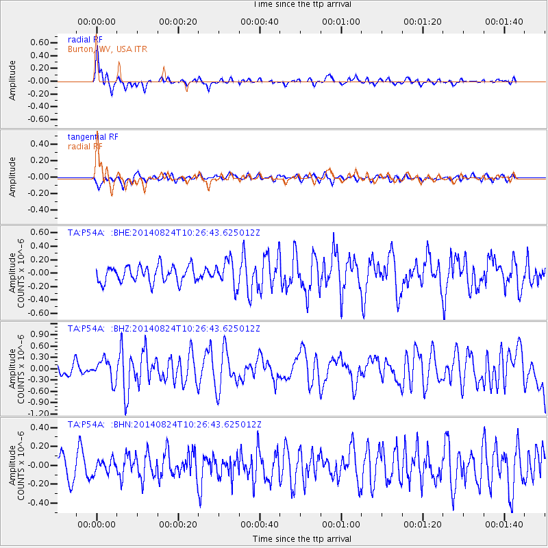
P54A Burton, WV, USA - Earthquake Result Viewer
*The percent match for this event was below the threshold and hence no stack was calculated.
| Earthquake location: |
Northern California |
| Earthquake latitude/longitude: |
38.2/-122.3 |
| Earthquake time(UTC): |
2014/08/24 (236) 10:20:44 GMT |
| Earthquake Depth: |
7.8 km |
| Earthquake Magnitude: |
6.0 MW, 6.1 MI |
| Earthquake Catalog/Contributor: |
NEIC PDE/NEIC ALERT |
|
| Network: |
TA USArray Transportable Network (new EarthScope stations) |
| Station: |
P54A Burton, WV, USA |
| Lat/Lon: |
39.61 N/80.48 W |
| Elevation: |
473 m |
|
| Distance: |
32.4 deg |
| Az: |
74.206 deg |
| Baz: |
281.107 deg |
| Ray Param: |
$rayparam |
*The percent match for this event was below the threshold and hence was not used in the summary stack. |
|
| Radial Match: |
73.06482 % |
| Radial Bump: |
396 |
| Transverse Match: |
47.85732 % |
| Transverse Bump: |
400 |
| SOD ConfigId: |
769524 |
| Insert Time: |
2014-09-07 10:51:37.710 +0000 |
| GWidth: |
2.5 |
| Max Bumps: |
400 |
| Tol: |
0.001 |
|
Signal To Noise
| Channel | StoN | STA | LTA |
| TA:P54A: :BHZ:20140824T10:26:43.625012Z | 1.7942312 | 2.9029957E-7 | 1.6179608E-7 |
| TA:P54A: :BHN:20140824T10:26:43.625012Z | 0.6688482 | 7.0191305E-8 | 1.0494355E-7 |
| TA:P54A: :BHE:20140824T10:26:43.625012Z | 1.699922 | 2.0311504E-7 | 1.1948492E-7 |
| Arrivals |
| Ps | |
| PpPs | |
| PsPs/PpSs | |


