You are here: Home > Network List > TA - USArray Transportable Network (new EarthScope stations) Stations List
> Station H63A New Sharon, ME, USA > Earthquake Result Viewer
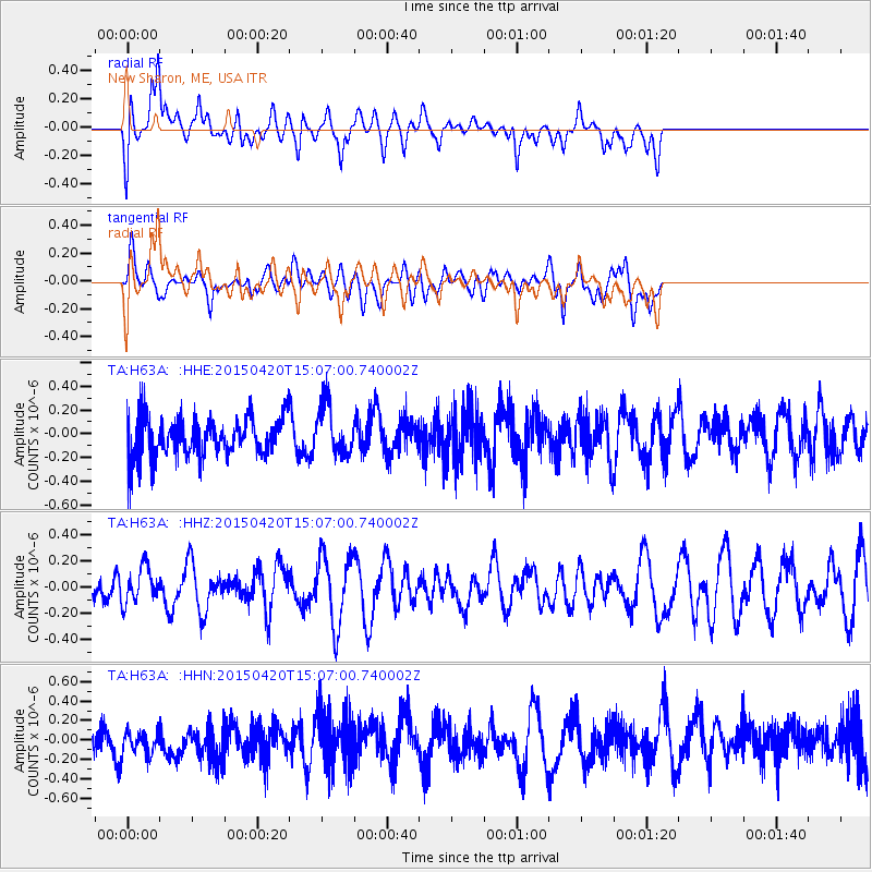
H63A New Sharon, ME, USA - Earthquake Result Viewer
*The percent match for this event was below the threshold and hence no stack was calculated.
| Earthquake location: |
Kuril Islands |
| Earthquake latitude/longitude: |
46.2/151.6 |
| Earthquake time(UTC): |
2015/04/20 (110) 14:55:21 GMT |
| Earthquake Depth: |
100 km |
| Earthquake Magnitude: |
4.4 mb, 4.4 mb |
| Earthquake Catalog/Contributor: |
ISC/ISC |
|
| Network: |
TA USArray Transportable Network (new EarthScope stations) |
| Station: |
H63A New Sharon, ME, USA |
| Lat/Lon: |
44.66 N/70.04 W |
| Elevation: |
109 m |
|
| Distance: |
82.4 deg |
| Az: |
28.553 deg |
| Baz: |
332.271 deg |
| Ray Param: |
$rayparam |
*The percent match for this event was below the threshold and hence was not used in the summary stack. |
|
| Radial Match: |
58.32948 % |
| Radial Bump: |
400 |
| Transverse Match: |
58.368015 % |
| Transverse Bump: |
400 |
| SOD ConfigId: |
7422571 |
| Insert Time: |
2019-04-18 06:58:14.337 +0000 |
| GWidth: |
2.5 |
| Max Bumps: |
400 |
| Tol: |
0.001 |
|
Signal To Noise
| Channel | StoN | STA | LTA |
| TA:H63A: :HHZ:20150420T15:07:00.740002Z | 1.092211 | 1.3953446E-7 | 1.2775412E-7 |
| TA:H63A: :HHN:20150420T15:07:00.740002Z | 0.6261629 | 1.5067816E-7 | 2.4063735E-7 |
| TA:H63A: :HHE:20150420T15:07:00.740002Z | 1.2756437 | 2.1116554E-7 | 1.6553645E-7 |
| Arrivals |
| Ps | |
| PpPs | |
| PsPs/PpSs | |


