You are here: Home > Network List > TA - USArray Transportable Network (new EarthScope stations) Stations List
> Station L04D Klamath Falls, OR, USA > Earthquake Result Viewer
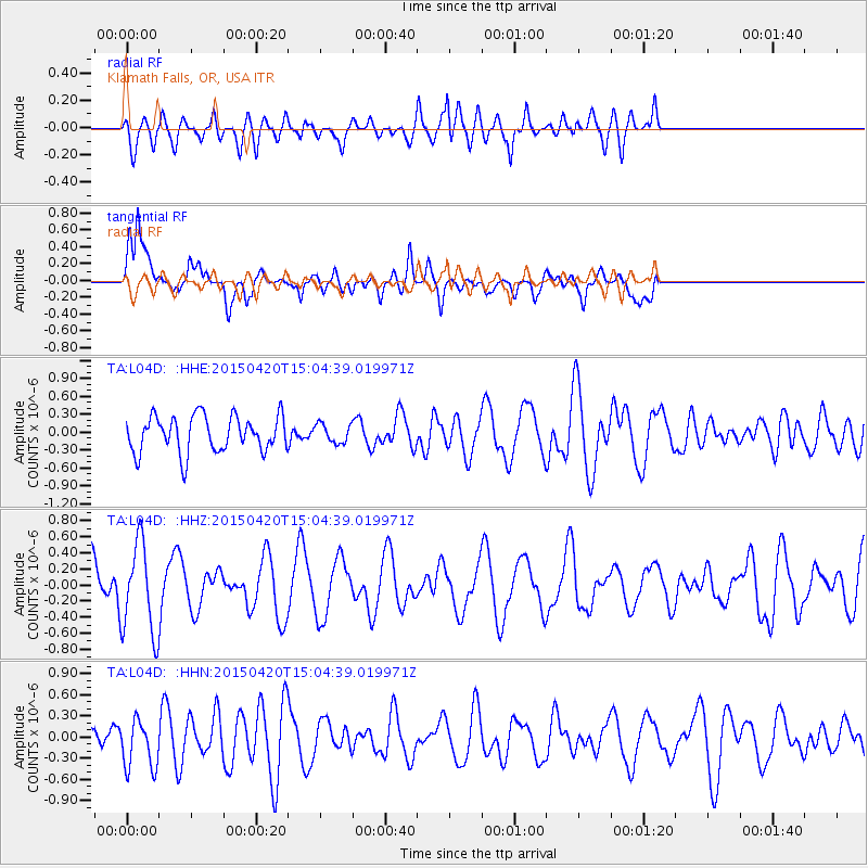
L04D Klamath Falls, OR, USA - Earthquake Result Viewer
*The percent match for this event was below the threshold and hence no stack was calculated.
| Earthquake location: |
Kuril Islands |
| Earthquake latitude/longitude: |
46.2/151.6 |
| Earthquake time(UTC): |
2015/04/20 (110) 14:55:21 GMT |
| Earthquake Depth: |
100 km |
| Earthquake Magnitude: |
4.4 mb, 4.4 mb |
| Earthquake Catalog/Contributor: |
ISC/ISC |
|
| Network: |
TA USArray Transportable Network (new EarthScope stations) |
| Station: |
L04D Klamath Falls, OR, USA |
| Lat/Lon: |
42.22 N/122.30 W |
| Elevation: |
1437 m |
|
| Distance: |
58.9 deg |
| Az: |
59.93 deg |
| Baz: |
305.969 deg |
| Ray Param: |
$rayparam |
*The percent match for this event was below the threshold and hence was not used in the summary stack. |
|
| Radial Match: |
54.0223 % |
| Radial Bump: |
400 |
| Transverse Match: |
67.87318 % |
| Transverse Bump: |
400 |
| SOD ConfigId: |
7422571 |
| Insert Time: |
2019-04-18 06:58:23.513 +0000 |
| GWidth: |
2.5 |
| Max Bumps: |
400 |
| Tol: |
0.001 |
|
Signal To Noise
| Channel | StoN | STA | LTA |
| TA:L04D: :HHZ:20150420T15:04:39.019971Z | 1.5730025 | 5.6258057E-7 | 3.576476E-7 |
| TA:L04D: :HHN:20150420T15:04:39.019971Z | 0.8772697 | 3.438944E-7 | 3.9200538E-7 |
| TA:L04D: :HHE:20150420T15:04:39.019971Z | 0.51518184 | 1.5582454E-7 | 3.024651E-7 |
| Arrivals |
| Ps | |
| PpPs | |
| PsPs/PpSs | |


