You are here: Home > Network List > TA - USArray Transportable Network (new EarthScope stations) Stations List
> Station R55A Marlinton, WV, USA > Earthquake Result Viewer
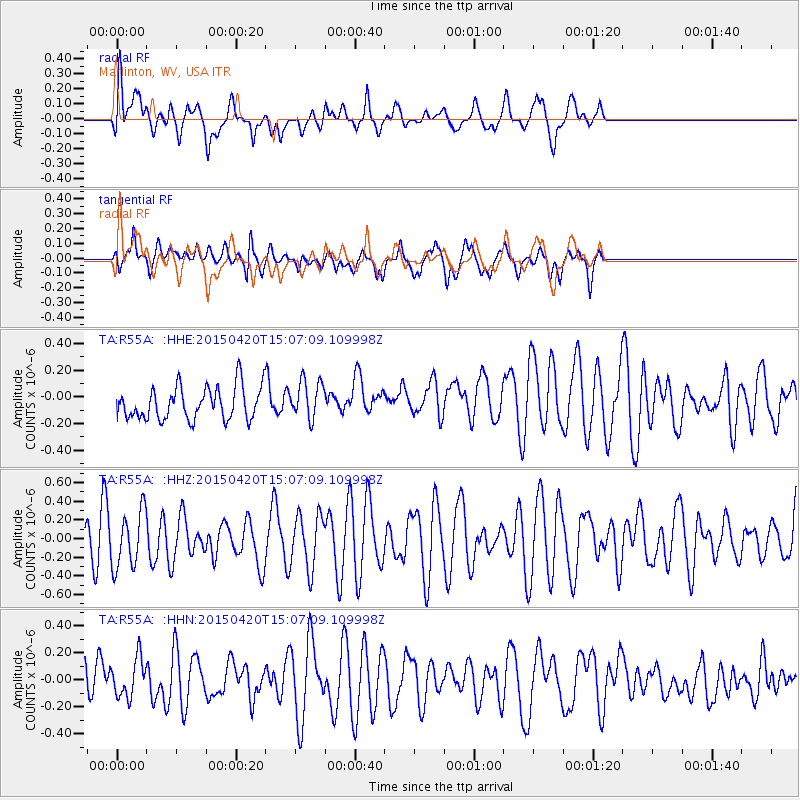
R55A Marlinton, WV, USA - Earthquake Result Viewer
*The percent match for this event was below the threshold and hence no stack was calculated.
| Earthquake location: |
Kuril Islands |
| Earthquake latitude/longitude: |
46.2/151.6 |
| Earthquake time(UTC): |
2015/04/20 (110) 14:55:21 GMT |
| Earthquake Depth: |
100 km |
| Earthquake Magnitude: |
4.4 mb, 4.4 mb |
| Earthquake Catalog/Contributor: |
ISC/ISC |
|
| Network: |
TA USArray Transportable Network (new EarthScope stations) |
| Station: |
R55A Marlinton, WV, USA |
| Lat/Lon: |
38.28 N/80.12 W |
| Elevation: |
833 m |
|
| Distance: |
84.0 deg |
| Az: |
38.376 deg |
| Baz: |
326.769 deg |
| Ray Param: |
$rayparam |
*The percent match for this event was below the threshold and hence was not used in the summary stack. |
|
| Radial Match: |
66.50695 % |
| Radial Bump: |
400 |
| Transverse Match: |
57.574036 % |
| Transverse Bump: |
400 |
| SOD ConfigId: |
7422571 |
| Insert Time: |
2019-04-18 06:58:41.795 +0000 |
| GWidth: |
2.5 |
| Max Bumps: |
400 |
| Tol: |
0.001 |
|
Signal To Noise
| Channel | StoN | STA | LTA |
| TA:R55A: :HHZ:20150420T15:07:09.109998Z | 1.8124733 | 3.004635E-7 | 1.6577542E-7 |
| TA:R55A: :HHN:20150420T15:07:09.109998Z | 0.58295524 | 1.4412048E-7 | 2.4722394E-7 |
| TA:R55A: :HHE:20150420T15:07:09.109998Z | 1.1881447 | 1.4397536E-7 | 1.2117663E-7 |
| Arrivals |
| Ps | |
| PpPs | |
| PsPs/PpSs | |


