You are here: Home > Network List > WY - Yellowstone Wyoming Seismic Network Stations List
> Station YHH Holmes Hill, YNP, WY, USA > Earthquake Result Viewer
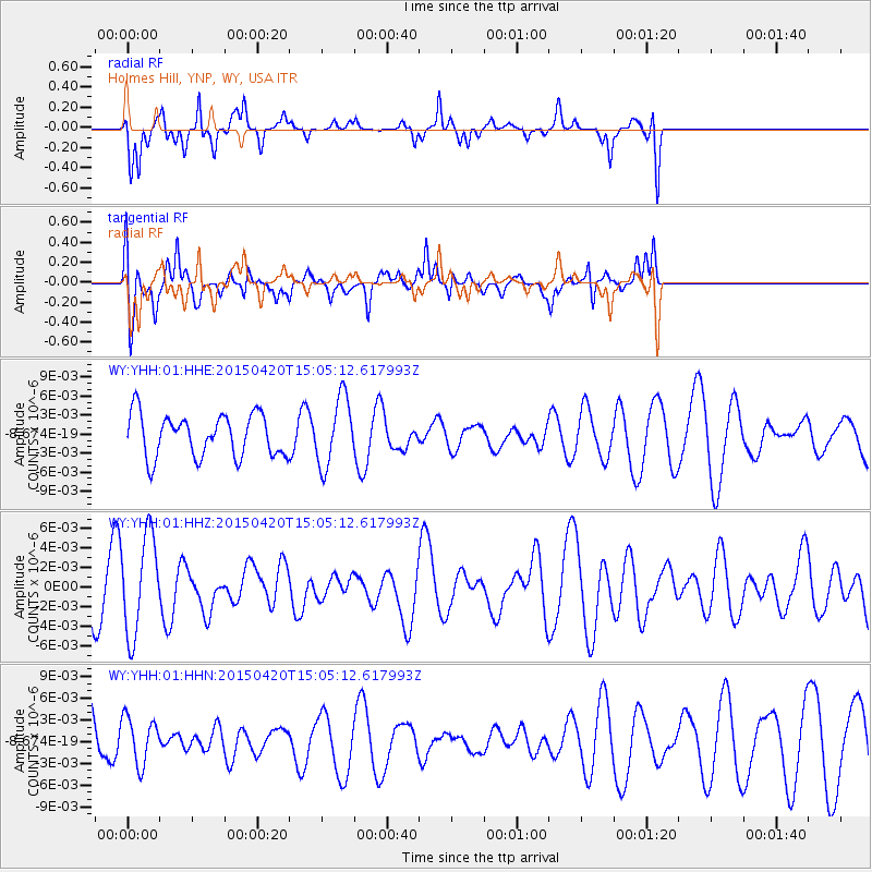
YHH Holmes Hill, YNP, WY, USA - Earthquake Result Viewer
*The percent match for this event was below the threshold and hence no stack was calculated.
| Earthquake location: |
Kuril Islands |
| Earthquake latitude/longitude: |
46.2/151.6 |
| Earthquake time(UTC): |
2015/04/20 (110) 14:55:21 GMT |
| Earthquake Depth: |
100 km |
| Earthquake Magnitude: |
4.4 mb, 4.4 mb |
| Earthquake Catalog/Contributor: |
ISC/ISC |
|
| Network: |
WY Yellowstone Wyoming Seismic Network |
| Station: |
YHH Holmes Hill, YNP, WY, USA |
| Lat/Lon: |
44.79 N/110.85 W |
| Elevation: |
2717 m |
|
| Distance: |
63.9 deg |
| Az: |
51.8 deg |
| Baz: |
309.943 deg |
| Ray Param: |
$rayparam |
*The percent match for this event was below the threshold and hence was not used in the summary stack. |
|
| Radial Match: |
58.69797 % |
| Radial Bump: |
375 |
| Transverse Match: |
49.269768 % |
| Transverse Bump: |
400 |
| SOD ConfigId: |
7422571 |
| Insert Time: |
2019-04-18 06:59:40.597 +0000 |
| GWidth: |
2.5 |
| Max Bumps: |
400 |
| Tol: |
0.001 |
|
Signal To Noise
| Channel | StoN | STA | LTA |
| WY:YHH:01:HHZ:20150420T15:05:12.617993Z | 1.662224 | 5.089842E-9 | 3.0620673E-9 |
| WY:YHH:01:HHN:20150420T15:05:12.617993Z | 0.69294965 | 3.2466676E-9 | 4.6852864E-9 |
| WY:YHH:01:HHE:20150420T15:05:12.617993Z | 1.6201229 | 5.405291E-9 | 3.336346E-9 |
| Arrivals |
| Ps | |
| PpPs | |
| PsPs/PpSs | |


