You are here: Home > Network List > IU - Global Seismograph Network (GSN - IRIS/USGS) Stations List
> Station PMG Port Moresby, New Guinea > Earthquake Result Viewer
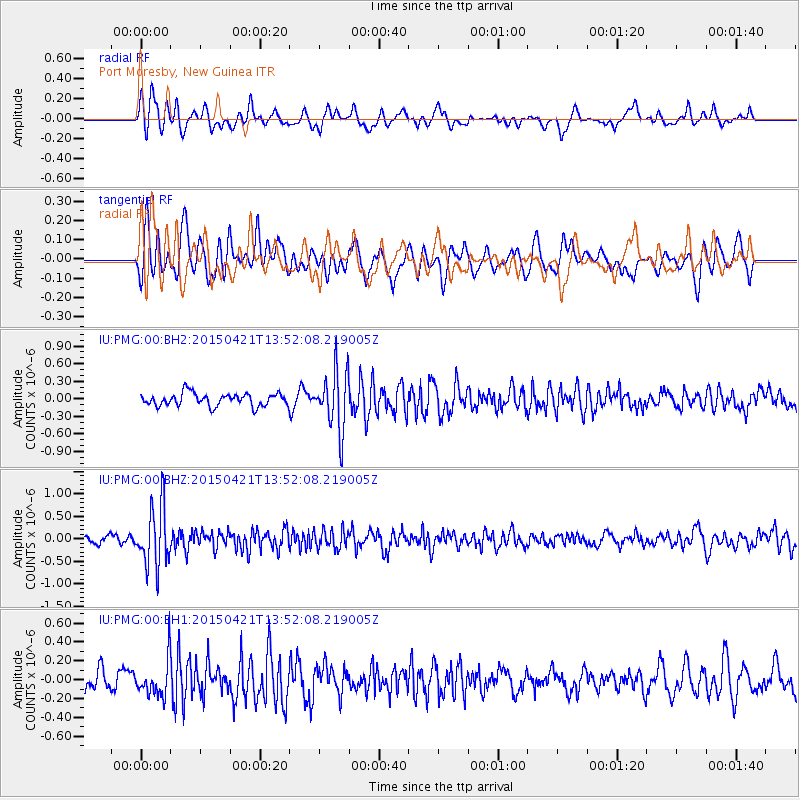
PMG Port Moresby, New Guinea - Earthquake Result Viewer
*The percent match for this event was below the threshold and hence no stack was calculated.
| Earthquake location: |
Fiji Islands Region |
| Earthquake latitude/longitude: |
-18.2/-178.1 |
| Earthquake time(UTC): |
2015/04/21 (111) 13:46:30 GMT |
| Earthquake Depth: |
494 km |
| Earthquake Magnitude: |
5.8 MW, 5.1 mb |
| Earthquake Catalog/Contributor: |
ISC/ISC |
|
| Network: |
IU Global Seismograph Network (GSN - IRIS/USGS) |
| Station: |
PMG Port Moresby, New Guinea |
| Lat/Lon: |
9.40 S/147.16 E |
| Elevation: |
90 m |
|
| Distance: |
34.8 deg |
| Az: |
279.779 deg |
| Baz: |
108.289 deg |
| Ray Param: |
$rayparam |
*The percent match for this event was below the threshold and hence was not used in the summary stack. |
|
| Radial Match: |
63.756653 % |
| Radial Bump: |
400 |
| Transverse Match: |
63.87719 % |
| Transverse Bump: |
400 |
| SOD ConfigId: |
7422571 |
| Insert Time: |
2019-04-18 07:20:24.674 +0000 |
| GWidth: |
2.5 |
| Max Bumps: |
400 |
| Tol: |
0.001 |
|
Signal To Noise
| Channel | StoN | STA | LTA |
| IU:PMG:00:BHZ:20150421T13:52:08.219005Z | 6.2536716 | 6.7553134E-7 | 1.0802155E-7 |
| IU:PMG:00:BH1:20150421T13:52:08.219005Z | 2.157805 | 1.9693711E-7 | 9.126733E-8 |
| IU:PMG:00:BH2:20150421T13:52:08.219005Z | 4.646501 | 5.0617683E-7 | 1.0893721E-7 |
| Arrivals |
| Ps | |
| PpPs | |
| PsPs/PpSs | |


