You are here: Home > Network List > TA - USArray Transportable Network (new EarthScope stations) Stations List
> Station H17A Grant Village (NPS), Yellowstone Nt. Park, WY, USA > Earthquake Result Viewer
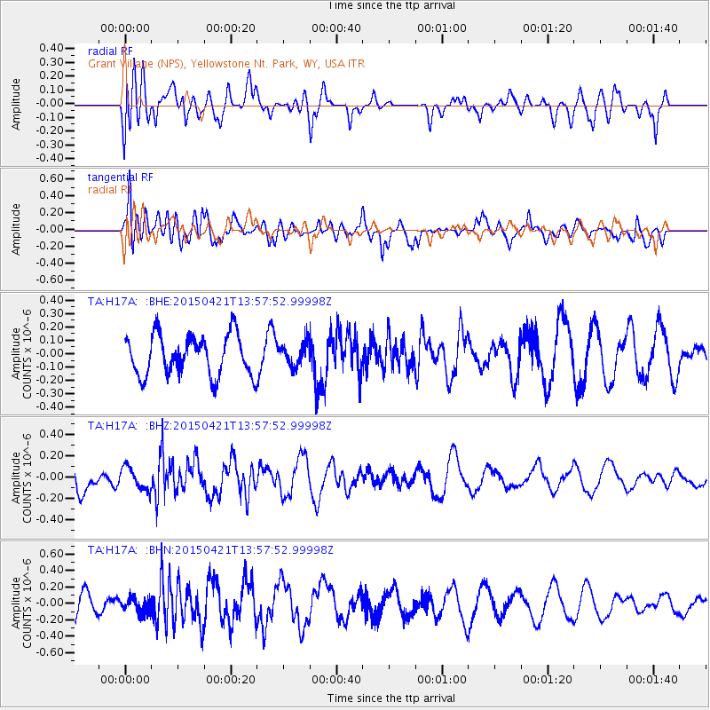
H17A Grant Village (NPS), Yellowstone Nt. Park, WY, USA - Earthquake Result Viewer
*The percent match for this event was below the threshold and hence no stack was calculated.
| Earthquake location: |
Fiji Islands Region |
| Earthquake latitude/longitude: |
-18.2/-178.1 |
| Earthquake time(UTC): |
2015/04/21 (111) 13:46:30 GMT |
| Earthquake Depth: |
494 km |
| Earthquake Magnitude: |
5.8 MW, 5.1 mb |
| Earthquake Catalog/Contributor: |
ISC/ISC |
|
| Network: |
TA USArray Transportable Network (new EarthScope stations) |
| Station: |
H17A Grant Village (NPS), Yellowstone Nt. Park, WY, USA |
| Lat/Lon: |
44.40 N/110.58 W |
| Elevation: |
2400 m |
|
| Distance: |
87.4 deg |
| Az: |
41.523 deg |
| Baz: |
241.541 deg |
| Ray Param: |
$rayparam |
*The percent match for this event was below the threshold and hence was not used in the summary stack. |
|
| Radial Match: |
56.385014 % |
| Radial Bump: |
400 |
| Transverse Match: |
70.115944 % |
| Transverse Bump: |
400 |
| SOD ConfigId: |
7422571 |
| Insert Time: |
2019-04-18 07:21:33.760 +0000 |
| GWidth: |
2.5 |
| Max Bumps: |
400 |
| Tol: |
0.001 |
|
Signal To Noise
| Channel | StoN | STA | LTA |
| TA:H17A: :BHZ:20150421T13:57:52.99998Z | 0.8855908 | 1.0532252E-7 | 1.1892911E-7 |
| TA:H17A: :BHN:20150421T13:57:52.99998Z | 0.48227203 | 9.28236E-8 | 1.9247145E-7 |
| TA:H17A: :BHE:20150421T13:57:52.99998Z | 0.5696778 | 8.465214E-8 | 1.4859653E-7 |
| Arrivals |
| Ps | |
| PpPs | |
| PsPs/PpSs | |


