You are here: Home > Network List > UW - Pacific Northwest Regional Seismic Network Stations List
> Station UMAT Pilot Rock, OR, USA > Earthquake Result Viewer
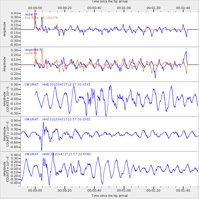
UMAT Pilot Rock, OR, USA - Earthquake Result Viewer
*The percent match for this event was below the threshold and hence no stack was calculated.
| Earthquake location: |
Fiji Islands Region |
| Earthquake latitude/longitude: |
-18.2/-178.1 |
| Earthquake time(UTC): |
2015/04/21 (111) 13:46:30 GMT |
| Earthquake Depth: |
494 km |
| Earthquake Magnitude: |
5.8 MW, 5.1 mb |
| Earthquake Catalog/Contributor: |
ISC/ISC |
|
| Network: |
UW Pacific Northwest Regional Seismic Network |
| Station: |
UMAT Pilot Rock, OR, USA |
| Lat/Lon: |
45.29 N/118.96 W |
| Elevation: |
1318 m |
|
| Distance: |
82.8 deg |
| Az: |
37.628 deg |
| Baz: |
235.312 deg |
| Ray Param: |
$rayparam |
*The percent match for this event was below the threshold and hence was not used in the summary stack. |
|
| Radial Match: |
55.25179 % |
| Radial Bump: |
349 |
| Transverse Match: |
51.57444 % |
| Transverse Bump: |
399 |
| SOD ConfigId: |
7422571 |
| Insert Time: |
2019-04-18 07:22:20.526 +0000 |
| GWidth: |
2.5 |
| Max Bumps: |
400 |
| Tol: |
0.001 |
|
Signal To Noise
| Channel | StoN | STA | LTA |
| UW:UMAT: :HHZ:20150421T13:57:30.658Z | 3.1620843 | 3.530978E-7 | 1.1166615E-7 |
| UW:UMAT: :HHN:20150421T13:57:30.658Z | 1.0015275 | 1.4856465E-7 | 1.4833806E-7 |
| UW:UMAT: :HHE:20150421T13:57:30.658Z | 0.84042567 | 1.1059556E-7 | 1.315947E-7 |
| Arrivals |
| Ps | |
| PpPs | |
| PsPs/PpSs | |


