You are here: Home > Network List > TA - USArray Transportable Network (new EarthScope stations) Stations List
> Station H17A Grant Village (NPS), Yellowstone Nt. Park, WY, USA > Earthquake Result Viewer
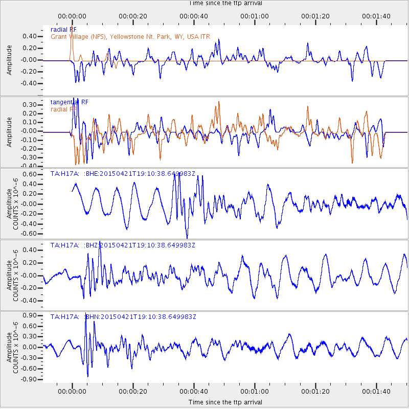
H17A Grant Village (NPS), Yellowstone Nt. Park, WY, USA - Earthquake Result Viewer
*The percent match for this event was below the threshold and hence no stack was calculated.
| Earthquake location: |
Central Peru |
| Earthquake latitude/longitude: |
-14.6/-71.1 |
| Earthquake time(UTC): |
2015/04/21 (111) 19:00:17 GMT |
| Earthquake Depth: |
119 km |
| Earthquake Magnitude: |
5.6 MB |
| Earthquake Catalog/Contributor: |
NEIC PDE/NEIC COMCAT |
|
| Network: |
TA USArray Transportable Network (new EarthScope stations) |
| Station: |
H17A Grant Village (NPS), Yellowstone Nt. Park, WY, USA |
| Lat/Lon: |
44.40 N/110.58 W |
| Elevation: |
2400 m |
|
| Distance: |
68.8 deg |
| Az: |
330.747 deg |
| Baz: |
138.705 deg |
| Ray Param: |
$rayparam |
*The percent match for this event was below the threshold and hence was not used in the summary stack. |
|
| Radial Match: |
67.50184 % |
| Radial Bump: |
400 |
| Transverse Match: |
53.48336 % |
| Transverse Bump: |
400 |
| SOD ConfigId: |
7422571 |
| Insert Time: |
2019-04-18 07:30:52.359 +0000 |
| GWidth: |
2.5 |
| Max Bumps: |
400 |
| Tol: |
0.001 |
|
Signal To Noise
| Channel | StoN | STA | LTA |
| TA:H17A: :BHZ:20150421T19:10:38.649983Z | 0.72580546 | 1.03703E-7 | 1.4287988E-7 |
| TA:H17A: :BHN:20150421T19:10:38.649983Z | 3.2842476 | 2.82131E-7 | 8.5904304E-8 |
| TA:H17A: :BHE:20150421T19:10:38.649983Z | 1.2032884 | 2.9693166E-7 | 2.4676683E-7 |
| Arrivals |
| Ps | |
| PpPs | |
| PsPs/PpSs | |


