You are here: Home > Network List > TA - USArray Transportable Network (new EarthScope stations) Stations List
> Station MSTX Muleshoe, TX, USA > Earthquake Result Viewer
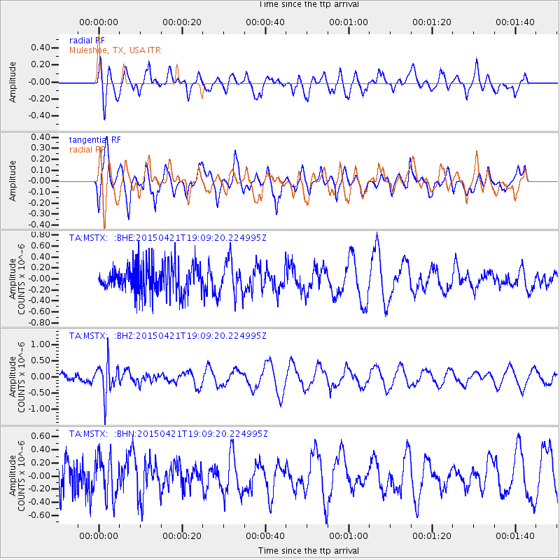
MSTX Muleshoe, TX, USA - Earthquake Result Viewer
*The percent match for this event was below the threshold and hence no stack was calculated.
| Earthquake location: |
Central Peru |
| Earthquake latitude/longitude: |
-14.6/-71.1 |
| Earthquake time(UTC): |
2015/04/21 (111) 19:00:17 GMT |
| Earthquake Depth: |
119 km |
| Earthquake Magnitude: |
5.6 MB |
| Earthquake Catalog/Contributor: |
NEIC PDE/NEIC COMCAT |
|
| Network: |
TA USArray Transportable Network (new EarthScope stations) |
| Station: |
MSTX Muleshoe, TX, USA |
| Lat/Lon: |
33.97 N/102.77 W |
| Elevation: |
1167 m |
|
| Distance: |
56.9 deg |
| Az: |
328.632 deg |
| Baz: |
142.671 deg |
| Ray Param: |
$rayparam |
*The percent match for this event was below the threshold and hence was not used in the summary stack. |
|
| Radial Match: |
53.109264 % |
| Radial Bump: |
400 |
| Transverse Match: |
71.22417 % |
| Transverse Bump: |
400 |
| SOD ConfigId: |
7422571 |
| Insert Time: |
2019-04-18 07:31:12.232 +0000 |
| GWidth: |
2.5 |
| Max Bumps: |
400 |
| Tol: |
0.001 |
|
Signal To Noise
| Channel | StoN | STA | LTA |
| TA:MSTX: :BHZ:20150421T19:09:20.224995Z | 4.062492 | 5.0220564E-7 | 1.236201E-7 |
| TA:MSTX: :BHN:20150421T19:09:20.224995Z | 0.9296799 | 3.1198383E-7 | 3.35582E-7 |
| TA:MSTX: :BHE:20150421T19:09:20.224995Z | 1.2306632 | 3.099623E-7 | 2.5186608E-7 |
| Arrivals |
| Ps | |
| PpPs | |
| PsPs/PpSs | |


