You are here: Home > Network List > TA - USArray Transportable Network (new EarthScope stations) Stations List
> Station O48A Farmland, IN, USA > Earthquake Result Viewer
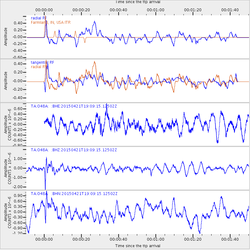
O48A Farmland, IN, USA - Earthquake Result Viewer
*The percent match for this event was below the threshold and hence no stack was calculated.
| Earthquake location: |
Central Peru |
| Earthquake latitude/longitude: |
-14.6/-71.1 |
| Earthquake time(UTC): |
2015/04/21 (111) 19:00:17 GMT |
| Earthquake Depth: |
119 km |
| Earthquake Magnitude: |
5.6 MB |
| Earthquake Catalog/Contributor: |
NEIC PDE/NEIC COMCAT |
|
| Network: |
TA USArray Transportable Network (new EarthScope stations) |
| Station: |
O48A Farmland, IN, USA |
| Lat/Lon: |
40.26 N/85.16 W |
| Elevation: |
300 m |
|
| Distance: |
56.1 deg |
| Az: |
347.071 deg |
| Baz: |
163.557 deg |
| Ray Param: |
$rayparam |
*The percent match for this event was below the threshold and hence was not used in the summary stack. |
|
| Radial Match: |
32.651337 % |
| Radial Bump: |
400 |
| Transverse Match: |
50.49486 % |
| Transverse Bump: |
400 |
| SOD ConfigId: |
7422571 |
| Insert Time: |
2019-04-18 07:31:15.461 +0000 |
| GWidth: |
2.5 |
| Max Bumps: |
400 |
| Tol: |
0.001 |
|
Signal To Noise
| Channel | StoN | STA | LTA |
| TA:O48A: :BHZ:20150421T19:09:15.12502Z | 3.1473868 | 6.1527436E-7 | 1.9548737E-7 |
| TA:O48A: :BHN:20150421T19:09:15.12502Z | 1.8615253 | 6.2523753E-7 | 3.3587378E-7 |
| TA:O48A: :BHE:20150421T19:09:15.12502Z | 1.8636509 | 3.4087086E-7 | 1.8290487E-7 |
| Arrivals |
| Ps | |
| PpPs | |
| PsPs/PpSs | |


