You are here: Home > Network List > UW - Pacific Northwest Regional Seismic Network Stations List
> Station UMAT Pilot Rock, OR, USA > Earthquake Result Viewer
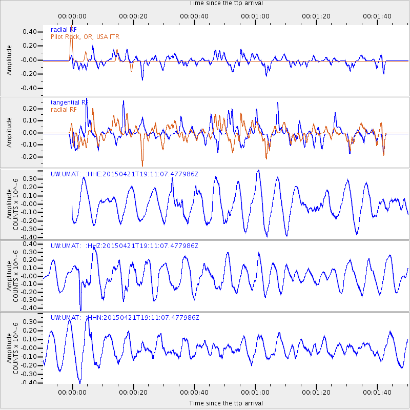
UMAT Pilot Rock, OR, USA - Earthquake Result Viewer
*The percent match for this event was below the threshold and hence no stack was calculated.
| Earthquake location: |
Central Peru |
| Earthquake latitude/longitude: |
-14.6/-71.1 |
| Earthquake time(UTC): |
2015/04/21 (111) 19:00:17 GMT |
| Earthquake Depth: |
119 km |
| Earthquake Magnitude: |
5.6 MB |
| Earthquake Catalog/Contributor: |
NEIC PDE/NEIC COMCAT |
|
| Network: |
UW Pacific Northwest Regional Seismic Network |
| Station: |
UMAT Pilot Rock, OR, USA |
| Lat/Lon: |
45.29 N/118.96 W |
| Elevation: |
1318 m |
|
| Distance: |
73.7 deg |
| Az: |
326.951 deg |
| Baz: |
131.586 deg |
| Ray Param: |
$rayparam |
*The percent match for this event was below the threshold and hence was not used in the summary stack. |
|
| Radial Match: |
40.458366 % |
| Radial Bump: |
400 |
| Transverse Match: |
55.05156 % |
| Transverse Bump: |
352 |
| SOD ConfigId: |
7422571 |
| Insert Time: |
2019-04-18 07:32:07.036 +0000 |
| GWidth: |
2.5 |
| Max Bumps: |
400 |
| Tol: |
0.001 |
|
Signal To Noise
| Channel | StoN | STA | LTA |
| UW:UMAT: :HHZ:20150421T19:11:07.477986Z | 1.2877175 | 1.5084255E-7 | 1.17139486E-7 |
| UW:UMAT: :HHN:20150421T19:11:07.477986Z | 3.418841 | 2.540944E-7 | 7.4321804E-8 |
| UW:UMAT: :HHE:20150421T19:11:07.477986Z | 1.0178105 | 1.4914072E-7 | 1.4653094E-7 |
| Arrivals |
| Ps | |
| PpPs | |
| PsPs/PpSs | |


