You are here: Home > Network List > US - United States National Seismic Network Stations List
> Station DGMT Dagmar, Montana, USA > Earthquake Result Viewer
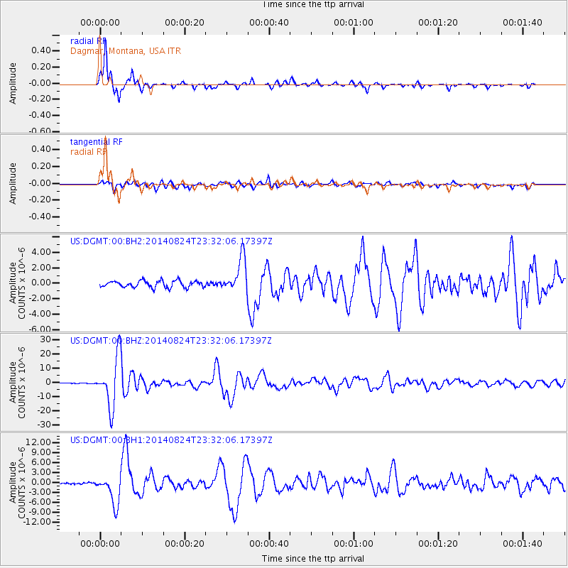
DGMT Dagmar, Montana, USA - Earthquake Result Viewer
*The percent match for this event was below the threshold and hence no stack was calculated.
| Earthquake location: |
Central Peru |
| Earthquake latitude/longitude: |
-14.6/-73.6 |
| Earthquake time(UTC): |
2014/08/24 (236) 23:21:45 GMT |
| Earthquake Depth: |
101 km |
| Earthquake Magnitude: |
6.9 MWW, 6.8 MI, 6.9 MWB |
| Earthquake Catalog/Contributor: |
NEIC PDE/NEIC COMCAT |
|
| Network: |
US United States National Seismic Network |
| Station: |
DGMT Dagmar, Montana, USA |
| Lat/Lon: |
48.47 N/104.20 W |
| Elevation: |
0.0 m |
|
| Distance: |
68.4 deg |
| Az: |
338.625 deg |
| Baz: |
147.978 deg |
| Ray Param: |
$rayparam |
*The percent match for this event was below the threshold and hence was not used in the summary stack. |
|
| Radial Match: |
98.06997 % |
| Radial Bump: |
319 |
| Transverse Match: |
86.85065 % |
| Transverse Bump: |
400 |
| SOD ConfigId: |
769524 |
| Insert Time: |
2014-09-08 00:11:34.902 +0000 |
| GWidth: |
2.5 |
| Max Bumps: |
400 |
| Tol: |
0.001 |
|
Signal To Noise
| Channel | StoN | STA | LTA |
| US:DGMT:00:BHZ:20140824T23:32:06.17397Z | 155.9516 | 1.7983913E-5 | 1.1531727E-7 |
| US:DGMT:00:BH1:20140824T23:32:06.17397Z | 18.612288 | 4.520757E-6 | 2.4289102E-7 |
| US:DGMT:00:BH2:20140824T23:32:06.17397Z | 5.3508763 | 2.3054406E-6 | 4.308529E-7 |
| Arrivals |
| Ps | |
| PpPs | |
| PsPs/PpSs | |


