You are here: Home > Network List > TA - USArray Transportable Network (new EarthScope stations) Stations List
> Station R56A Bull Pasture Mountain, McDowell, VA, USA > Earthquake Result Viewer
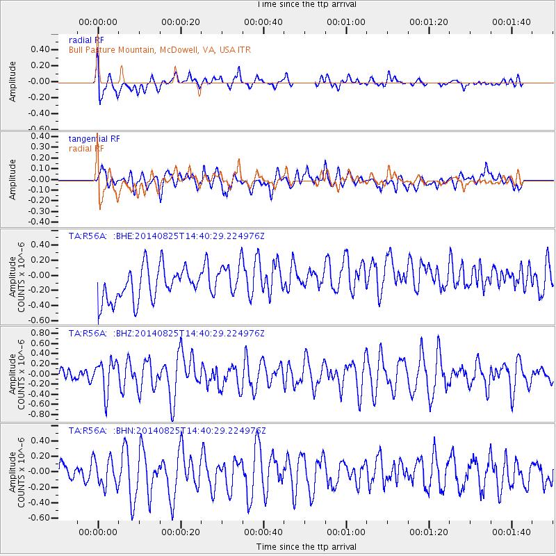
R56A Bull Pasture Mountain, McDowell, VA, USA - Earthquake Result Viewer
*The percent match for this event was below the threshold and hence no stack was calculated.
| Earthquake location: |
Near Coast Of Peru |
| Earthquake latitude/longitude: |
-16.2/-73.2 |
| Earthquake time(UTC): |
2014/08/25 (237) 14:31:37 GMT |
| Earthquake Depth: |
58 km |
| Earthquake Magnitude: |
5.6 M |
| Earthquake Catalog/Contributor: |
NEIC PDE/NEIC ALERT |
|
| Network: |
TA USArray Transportable Network (new EarthScope stations) |
| Station: |
R56A Bull Pasture Mountain, McDowell, VA, USA |
| Lat/Lon: |
38.41 N/79.40 W |
| Elevation: |
902 m |
|
| Distance: |
54.6 deg |
| Az: |
354.067 deg |
| Baz: |
172.738 deg |
| Ray Param: |
$rayparam |
*The percent match for this event was below the threshold and hence was not used in the summary stack. |
|
| Radial Match: |
57.4965 % |
| Radial Bump: |
400 |
| Transverse Match: |
39.719856 % |
| Transverse Bump: |
400 |
| SOD ConfigId: |
769524 |
| Insert Time: |
2014-09-08 15:05:04.800 +0000 |
| GWidth: |
2.5 |
| Max Bumps: |
400 |
| Tol: |
0.001 |
|
Signal To Noise
| Channel | StoN | STA | LTA |
| TA:R56A: :BHZ:20140825T14:40:29.224976Z | 2.94548 | 3.2145684E-7 | 1.0913563E-7 |
| TA:R56A: :BHN:20140825T14:40:29.224976Z | 1.3107249 | 1.7488938E-7 | 1.3342951E-7 |
| TA:R56A: :BHE:20140825T14:40:29.224976Z | 1.069975 | 2.3260694E-7 | 2.1739473E-7 |
| Arrivals |
| Ps | |
| PpPs | |
| PsPs/PpSs | |


