You are here: Home > Network List > UW - Pacific Northwest Regional Seismic Network Stations List
> Station LEBA Lebam, WA, USA > Earthquake Result Viewer
LEBA Lebam, WA, USA - Earthquake Result Viewer
*The percent match for this event was below the threshold and hence no stack was calculated.
| Earthquake location: |
Near Coast Of Peru |
| Earthquake latitude/longitude: |
-16.2/-73.2 |
| Earthquake time(UTC): |
2014/08/25 (237) 14:31:37 GMT |
| Earthquake Depth: |
58 km |
| Earthquake Magnitude: |
5.6 M |
| Earthquake Catalog/Contributor: |
NEIC PDE/NEIC ALERT |
|
| Network: |
UW Pacific Northwest Regional Seismic Network |
| Station: |
LEBA Lebam, WA, USA |
| Lat/Lon: |
46.55 N/123.56 W |
| Elevation: |
73 m |
|
| Distance: |
77.1 deg |
| Az: |
326.984 deg |
| Baz: |
130.672 deg |
| Ray Param: |
$rayparam |
*The percent match for this event was below the threshold and hence was not used in the summary stack. |
|
| Radial Match: |
45.71053 % |
| Radial Bump: |
378 |
| Transverse Match: |
61.404808 % |
| Transverse Bump: |
400 |
| SOD ConfigId: |
769524 |
| Insert Time: |
2014-09-08 15:08:42.769 +0000 |
| GWidth: |
2.5 |
| Max Bumps: |
400 |
| Tol: |
0.001 |
|
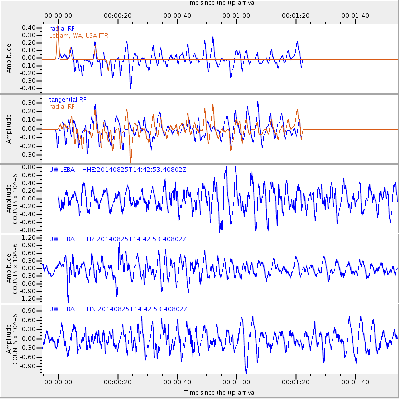
Signal To Noise
| Channel | StoN | STA | LTA |
| UW:LEBA: :HHZ:20140825T14:42:53.40802Z | 2.9322405 | 4.1389478E-7 | 1.4115308E-7 |
| UW:LEBA: :HHN:20140825T14:42:53.40802Z | 1.0259006 | 2.7755007E-7 | 2.7054284E-7 |
| UW:LEBA: :HHE:20140825T14:42:53.40802Z | 0.9354805 | 1.8518865E-7 | 1.97961E-7 |
| Arrivals |
| Ps | |
| PpPs | |
| PsPs/PpSs | |


