You are here: Home > Network List > IU - Global Seismograph Network (GSN - IRIS/USGS) Stations List
> Station SLBS Sierra la Laguna Baja California Sur, Mexico > Earthquake Result Viewer
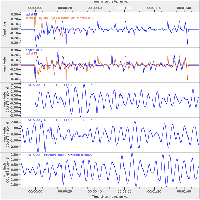
SLBS Sierra la Laguna Baja California Sur, Mexico - Earthquake Result Viewer
*The percent match for this event was below the threshold and hence no stack was calculated.
| Earthquake location: |
Fiji Islands Region |
| Earthquake latitude/longitude: |
-17.0/174.5 |
| Earthquake time(UTC): |
2009/10/02 (275) 15:47:09 GMT |
| Earthquake Depth: |
10 km |
| Earthquake Magnitude: |
5.7 MB, 5.6 MS, 6.0 MW, 5.8 MW |
| Earthquake Catalog/Contributor: |
WHDF/NEIC |
|
| Network: |
IU Global Seismograph Network (GSN - IRIS/USGS) |
| Station: |
SLBS Sierra la Laguna Baja California Sur, Mexico |
| Lat/Lon: |
23.69 N/109.94 W |
| Elevation: |
825 m |
|
| Distance: |
84.1 deg |
| Az: |
63.185 deg |
| Baz: |
248.658 deg |
| Ray Param: |
$rayparam |
*The percent match for this event was below the threshold and hence was not used in the summary stack. |
|
| Radial Match: |
58.549854 % |
| Radial Bump: |
400 |
| Transverse Match: |
42.65482 % |
| Transverse Bump: |
400 |
| SOD ConfigId: |
1 |
| Insert Time: |
2010-02-19 00:28:11.862 +0000 |
| GWidth: |
2.5 |
| Max Bumps: |
400 |
| Tol: |
0.001 |
|
Signal To Noise
| Channel | StoN | STA | LTA |
| IU:SLBS:00:BHZ:20091002T15:59:08.87002Z | 2.5673347 | 1.7762585E-6 | 6.9186876E-7 |
| IU:SLBS:00:BHN:20091002T15:59:08.87002Z | 0.7315622 | 4.4407352E-7 | 6.070208E-7 |
| IU:SLBS:00:BHE:20091002T15:59:08.87002Z | 1.7356383 | 1.3501993E-6 | 7.779267E-7 |
| Arrivals |
| Ps | |
| PpPs | |
| PsPs/PpSs | |


