You are here: Home > Network List > TA - USArray Transportable Network (new EarthScope stations) Stations List
> Station R11A Troy Canyon, Currant, NV, USA > Earthquake Result Viewer
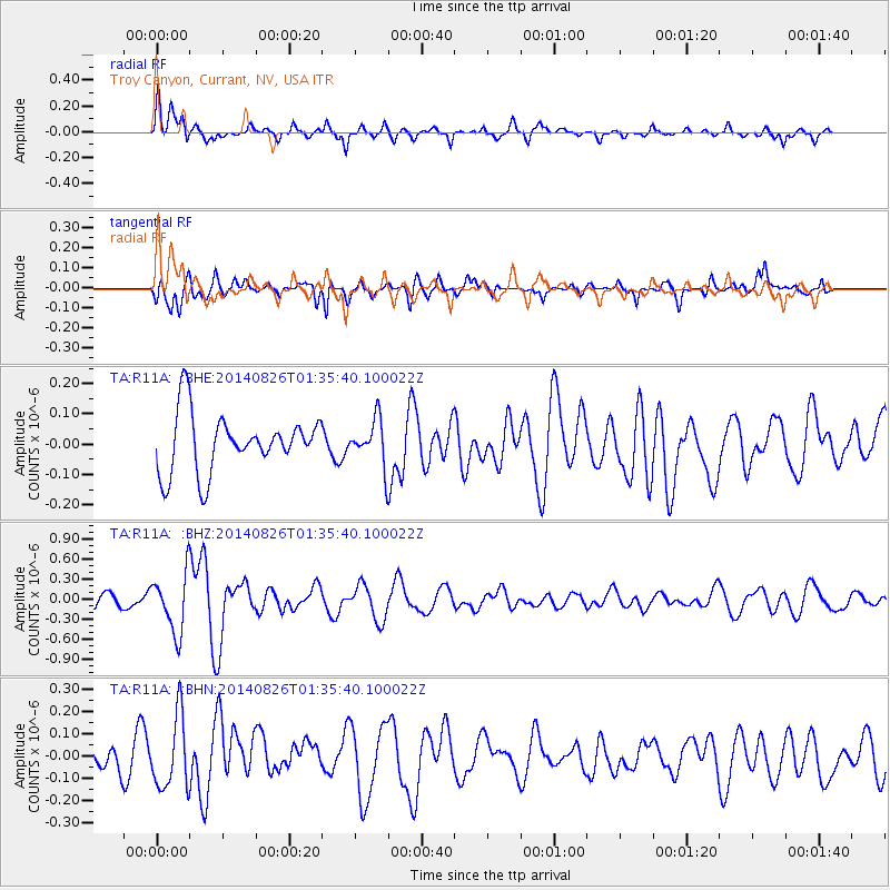
R11A Troy Canyon, Currant, NV, USA - Earthquake Result Viewer
*The percent match for this event was below the threshold and hence no stack was calculated.
| Earthquake location: |
Iceland |
| Earthquake latitude/longitude: |
64.7/-17.5 |
| Earthquake time(UTC): |
2014/08/26 (238) 01:26:08 GMT |
| Earthquake Depth: |
5.0 km |
| Earthquake Magnitude: |
5.7 MWP |
| Earthquake Catalog/Contributor: |
NEIC PDE/NEIC COMCAT |
|
| Network: |
TA USArray Transportable Network (new EarthScope stations) |
| Station: |
R11A Troy Canyon, Currant, NV, USA |
| Lat/Lon: |
38.35 N/115.59 W |
| Elevation: |
1756 m |
|
| Distance: |
59.3 deg |
| Az: |
295.162 deg |
| Baz: |
29.689 deg |
| Ray Param: |
$rayparam |
*The percent match for this event was below the threshold and hence was not used in the summary stack. |
|
| Radial Match: |
68.46102 % |
| Radial Bump: |
390 |
| Transverse Match: |
62.703857 % |
| Transverse Bump: |
400 |
| SOD ConfigId: |
769524 |
| Insert Time: |
2014-09-09 02:19:25.323 +0000 |
| GWidth: |
2.5 |
| Max Bumps: |
400 |
| Tol: |
0.001 |
|
Signal To Noise
| Channel | StoN | STA | LTA |
| TA:R11A: :BHZ:20140826T01:35:40.100022Z | 3.5915768 | 4.366392E-7 | 1.2157312E-7 |
| TA:R11A: :BHN:20140826T01:35:40.100022Z | 2.031044 | 1.6247897E-7 | 7.9997754E-8 |
| TA:R11A: :BHE:20140826T01:35:40.100022Z | 0.7739181 | 7.408305E-8 | 9.572466E-8 |
| Arrivals |
| Ps | |
| PpPs | |
| PsPs/PpSs | |


