You are here: Home > Network List > UW - Pacific Northwest Regional Seismic Network Stations List
> Station LEBA Lebam, WA, USA > Earthquake Result Viewer
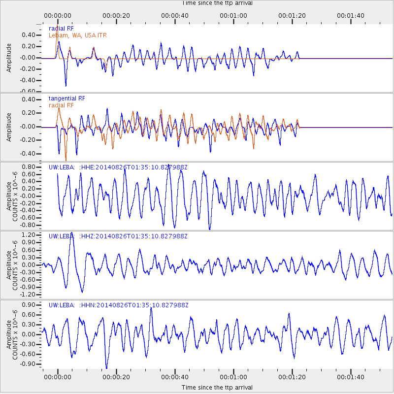
LEBA Lebam, WA, USA - Earthquake Result Viewer
*The percent match for this event was below the threshold and hence no stack was calculated.
| Earthquake location: |
Iceland |
| Earthquake latitude/longitude: |
64.7/-17.5 |
| Earthquake time(UTC): |
2014/08/26 (238) 01:26:08 GMT |
| Earthquake Depth: |
5.0 km |
| Earthquake Magnitude: |
5.7 MWP |
| Earthquake Catalog/Contributor: |
NEIC PDE/NEIC COMCAT |
|
| Network: |
UW Pacific Northwest Regional Seismic Network |
| Station: |
LEBA Lebam, WA, USA |
| Lat/Lon: |
46.55 N/123.56 W |
| Elevation: |
73 m |
|
| Distance: |
55.2 deg |
| Az: |
306.105 deg |
| Baz: |
30.242 deg |
| Ray Param: |
$rayparam |
*The percent match for this event was below the threshold and hence was not used in the summary stack. |
|
| Radial Match: |
64.23272 % |
| Radial Bump: |
400 |
| Transverse Match: |
52.945015 % |
| Transverse Bump: |
400 |
| SOD ConfigId: |
769524 |
| Insert Time: |
2014-09-09 02:24:45.074 +0000 |
| GWidth: |
2.5 |
| Max Bumps: |
400 |
| Tol: |
0.001 |
|
Signal To Noise
| Channel | StoN | STA | LTA |
| UW:LEBA: :HHZ:20140826T01:35:10.827988Z | 4.0066795 | 5.8745087E-7 | 1.4661788E-7 |
| UW:LEBA: :HHN:20140826T01:35:10.827988Z | 1.1999184 | 3.0768445E-7 | 2.5642117E-7 |
| UW:LEBA: :HHE:20140826T01:35:10.827988Z | 0.8006997 | 2.747731E-7 | 3.4316622E-7 |
| Arrivals |
| Ps | |
| PpPs | |
| PsPs/PpSs | |


