You are here: Home > Network List > TA - USArray Transportable Network (new EarthScope stations) Stations List
> Station MSTX Muleshoe, TX, USA > Earthquake Result Viewer
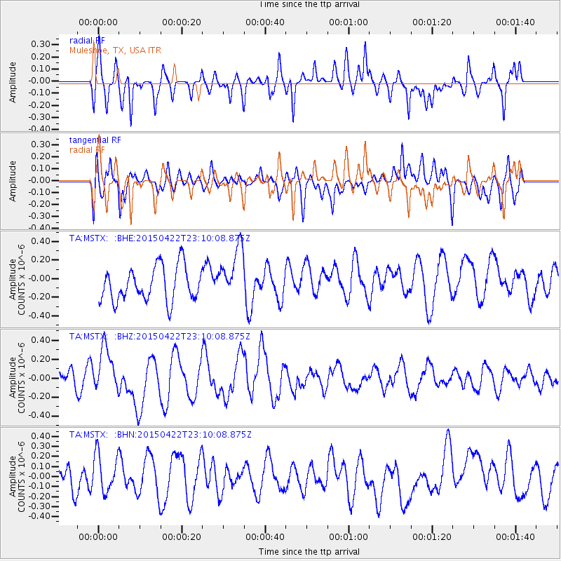
MSTX Muleshoe, TX, USA - Earthquake Result Viewer
*The percent match for this event was below the threshold and hence no stack was calculated.
| Earthquake location: |
Santa Cruz Islands |
| Earthquake latitude/longitude: |
-12.0/166.4 |
| Earthquake time(UTC): |
2015/04/22 (112) 22:57:16 GMT |
| Earthquake Depth: |
74 km |
| Earthquake Magnitude: |
5.8 MB |
| Earthquake Catalog/Contributor: |
NEIC PDE/NEIC ALERT |
|
| Network: |
TA USArray Transportable Network (new EarthScope stations) |
| Station: |
MSTX Muleshoe, TX, USA |
| Lat/Lon: |
33.97 N/102.77 W |
| Elevation: |
1167 m |
|
| Distance: |
97.3 deg |
| Az: |
56.906 deg |
| Baz: |
260.499 deg |
| Ray Param: |
$rayparam |
*The percent match for this event was below the threshold and hence was not used in the summary stack. |
|
| Radial Match: |
61.089504 % |
| Radial Bump: |
400 |
| Transverse Match: |
52.45546 % |
| Transverse Bump: |
400 |
| SOD ConfigId: |
7422571 |
| Insert Time: |
2019-04-18 07:54:24.940 +0000 |
| GWidth: |
2.5 |
| Max Bumps: |
400 |
| Tol: |
0.001 |
|
Signal To Noise
| Channel | StoN | STA | LTA |
| TA:MSTX: :BHZ:20150422T23:10:08.875Z | 2.5286505 | 2.4257193E-7 | 9.59294E-8 |
| TA:MSTX: :BHN:20150422T23:10:08.875Z | 1.7999421 | 2.1117033E-7 | 1.17320624E-7 |
| TA:MSTX: :BHE:20150422T23:10:08.875Z | 1.6085835 | 2.9649806E-7 | 1.8432246E-7 |
| Arrivals |
| Ps | |
| PpPs | |
| PsPs/PpSs | |


