You are here: Home > Network List > UW - Pacific Northwest Regional Seismic Network Stations List
> Station MRBL Marblemount, WA, USA > Earthquake Result Viewer
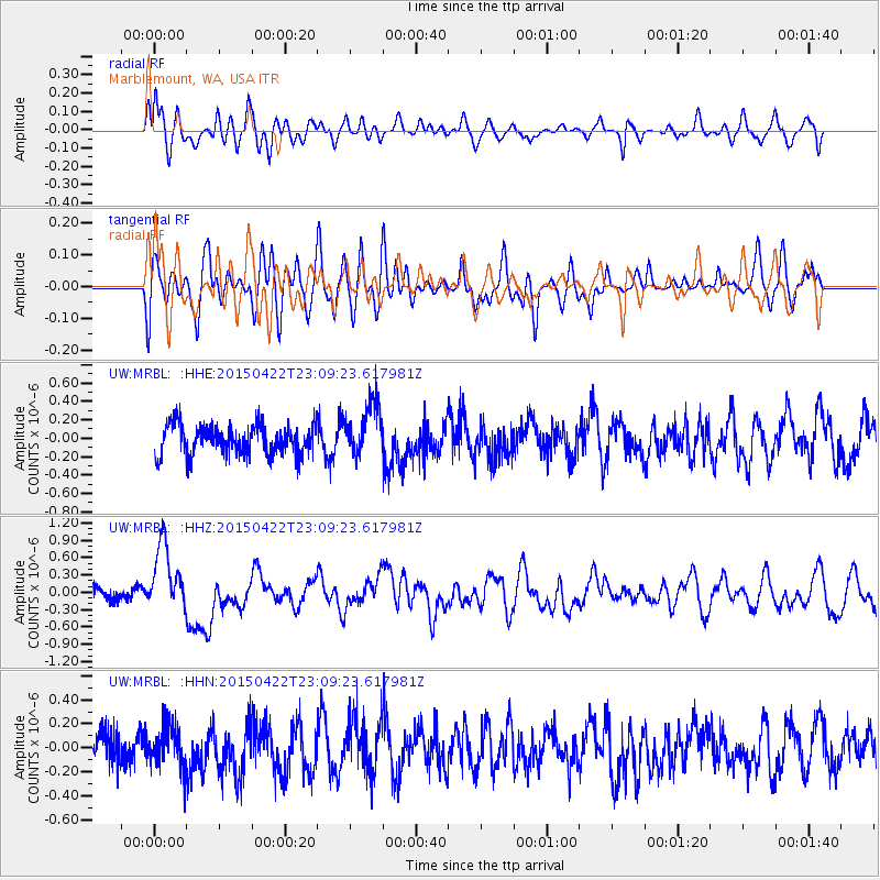
MRBL Marblemount, WA, USA - Earthquake Result Viewer
*The percent match for this event was below the threshold and hence no stack was calculated.
| Earthquake location: |
Santa Cruz Islands |
| Earthquake latitude/longitude: |
-12.0/166.4 |
| Earthquake time(UTC): |
2015/04/22 (112) 22:57:16 GMT |
| Earthquake Depth: |
74 km |
| Earthquake Magnitude: |
5.8 MB |
| Earthquake Catalog/Contributor: |
NEIC PDE/NEIC ALERT |
|
| Network: |
UW Pacific Northwest Regional Seismic Network |
| Station: |
MRBL Marblemount, WA, USA |
| Lat/Lon: |
48.52 N/121.48 W |
| Elevation: |
75 m |
|
| Distance: |
87.4 deg |
| Az: |
39.308 deg |
| Baz: |
248.781 deg |
| Ray Param: |
$rayparam |
*The percent match for this event was below the threshold and hence was not used in the summary stack. |
|
| Radial Match: |
61.08868 % |
| Radial Bump: |
400 |
| Transverse Match: |
56.141846 % |
| Transverse Bump: |
400 |
| SOD ConfigId: |
7422571 |
| Insert Time: |
2019-04-18 07:55:22.218 +0000 |
| GWidth: |
2.5 |
| Max Bumps: |
400 |
| Tol: |
0.001 |
|
Signal To Noise
| Channel | StoN | STA | LTA |
| UW:MRBL: :HHZ:20150422T23:09:23.617981Z | 4.0822926 | 5.9321843E-7 | 1.4531503E-7 |
| UW:MRBL: :HHN:20150422T23:09:23.617981Z | 0.94849986 | 1.6708823E-7 | 1.7616053E-7 |
| UW:MRBL: :HHE:20150422T23:09:23.617981Z | 1.9465894 | 3.01875E-7 | 1.5507892E-7 |
| Arrivals |
| Ps | |
| PpPs | |
| PsPs/PpSs | |


