You are here: Home > Network List > US - United States National Seismic Network Stations List
> Station AMTX Amarillo, Texas, USA > Earthquake Result Viewer
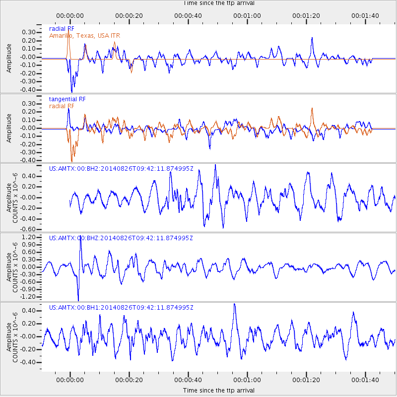
AMTX Amarillo, Texas, USA - Earthquake Result Viewer
*The percent match for this event was below the threshold and hence no stack was calculated.
| Earthquake location: |
Tonga Islands |
| Earthquake latitude/longitude: |
-15.2/-173.2 |
| Earthquake time(UTC): |
2014/08/26 (238) 09:30:12 GMT |
| Earthquake Depth: |
10 km |
| Earthquake Magnitude: |
5.6 MB |
| Earthquake Catalog/Contributor: |
NEIC PDE/NEIC COMCAT |
|
| Network: |
US United States National Seismic Network |
| Station: |
AMTX Amarillo, Texas, USA |
| Lat/Lon: |
34.53 N/101.41 W |
| Elevation: |
1010 m |
|
| Distance: |
84.1 deg |
| Az: |
52.015 deg |
| Baz: |
247.154 deg |
| Ray Param: |
$rayparam |
*The percent match for this event was below the threshold and hence was not used in the summary stack. |
|
| Radial Match: |
70.98649 % |
| Radial Bump: |
400 |
| Transverse Match: |
46.49506 % |
| Transverse Bump: |
400 |
| SOD ConfigId: |
769524 |
| Insert Time: |
2014-09-09 10:01:19.779 +0000 |
| GWidth: |
2.5 |
| Max Bumps: |
400 |
| Tol: |
0.001 |
|
Signal To Noise
| Channel | StoN | STA | LTA |
| US:AMTX:00:BHZ:20140826T09:42:11.874995Z | 2.8919754 | 5.1534244E-7 | 1.7819738E-7 |
| US:AMTX:00:BH1:20140826T09:42:11.874995Z | 0.6904795 | 1.4374629E-7 | 2.0818327E-7 |
| US:AMTX:00:BH2:20140826T09:42:11.874995Z | 2.0017247 | 2.1976446E-7 | 1.0978755E-7 |
| Arrivals |
| Ps | |
| PpPs | |
| PsPs/PpSs | |


